SSB Saint Sauveur Badole, France - Earthquake Result Viewer
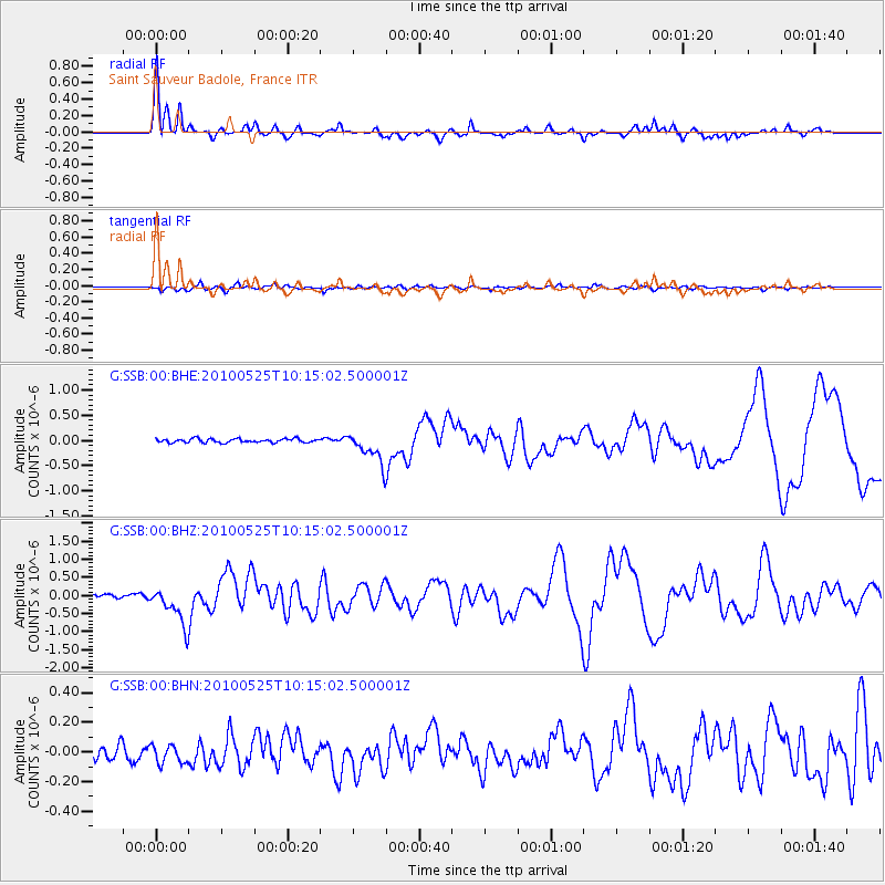
Earthquake location: Northern Mid-Atlantic Ridge
Earthquake latitude/longitude: 35.3/-35.9
Earthquake time(UTC): 2010/05/25 (145) 10:09:05 GMT
Earthquake Depth: 10 km
Earthquake Magnitude: 5.5 MB, 5.5 MS, 6.3 MW, 6.3 MW
Earthquake Catalog/Contributor: WHDF/NEIC
Network: G GEOSCOPE
Station: SSB Saint Sauveur Badole, France
Lat/Lon: 45.28 N/4.54 E
Elevation: 700 m
Distance: 32.1 deg
Az: 59.517 deg
Baz: 266.336 deg
Ray Param: 0.0787866
Estimated Moho Depth: 34.0 km
Estimated Crust Vp/Vs: 1.60
Assumed Crust Vp: 6.1 km/s
Estimated Crust Vs: 3.812 km/s
Estimated Crust Poisson's Ratio: 0.18
Radial Match: 90.71515 %
Radial Bump: 318
Transverse Match: 62.781445 %
Transverse Bump: 400
SOD ConfigId: 314592
Insert Time: 2010-09-14 06:33:21.815 +0000
GWidth: 2.5
Max Bumps: 400
Tol: 0.001

Signal To Noise

ChannelStoNSTALTA
G:SSB:00:BHZ:20100525T10:15:02.500001Z8.1432655.364967E-76.588226E-8
G:SSB:00:BHN:20100525T10:15:02.500001Z1.20103036.317884E-85.2603866E-8
G:SSB:00:BHE:20100525T10:15:02.500001Z8.1599193.0892298E-73.7858584E-8
Arrivals
Ps3.6 SECOND
PpPs13 SECOND
PsPs/PpSs17 SECOND