
CLF Chambon la Foret observatory, France - Earthquake Result Viewer
| ||||||||||||||||||
| ||||||||||||||||||
| ||||||||||||||||||
|
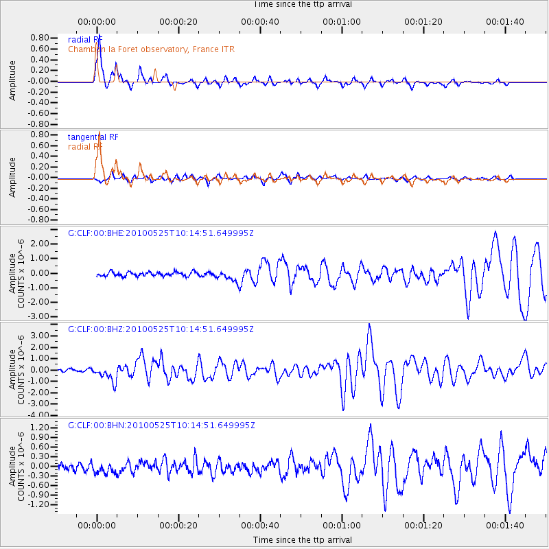
Signal To Noise
| Channel | StoN | STA | LTA |
| G:CLF:00:BHZ:20100525T10:14:51.649995Z | 6.778132 | 7.264337E-7 | 1.0717314E-7 |
| G:CLF:00:BHN:20100525T10:14:51.649995Z | 1.1104944 | 1.6816459E-7 | 1.5143218E-7 |
| G:CLF:00:BHE:20100525T10:14:51.649995Z | 2.762878 | 3.8568245E-7 | 1.3959445E-7 |
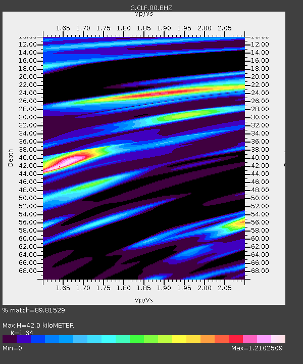
| Arrivals | |
| Ps | 4.7 SECOND |
| PpPs | 17 SECOND |
| PsPs/PpSs | 22 SECOND |

