You are here: Home > Network List > WW - Idaho Seismic Network () Stations List
> Station BILL Emerald Creek, Idaho > Earthquake Result Viewer
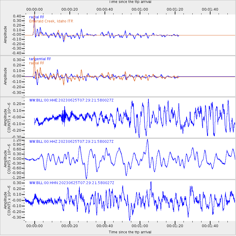
BILL Emerald Creek, Idaho - Earthquake Result Viewer
*The percent match for this event was below the threshold and hence no stack was calculated.
| Earthquake location: |
South Of Tonga Islands |
| Earthquake latitude/longitude: |
-24.0/-175.6 |
| Earthquake time(UTC): |
2023/06/25 (176) 07:16:59 GMT |
| Earthquake Depth: |
7.1 km |
| Earthquake Magnitude: |
6.0 mww |
| Earthquake Catalog/Contributor: |
NEIC PDE/us |
|
| Network: |
WW Idaho Seismic Network () |
| Station: |
BILL Emerald Creek, Idaho |
| Lat/Lon: |
47.03 N/116.34 W |
| Elevation: |
866 m |
|
| Distance: |
88.6 deg |
| Az: |
36.034 deg |
| Baz: |
231.843 deg |
| Ray Param: |
$rayparam |
*The percent match for this event was below the threshold and hence was not used in the summary stack. |
|
| Radial Match: |
74.309456 % |
| Radial Bump: |
400 |
| Transverse Match: |
79.39873 % |
| Transverse Bump: |
400 |
| SOD ConfigId: |
30536071 |
| Insert Time: |
2023-07-09 07:43:15.386 +0000 |
| GWidth: |
2.5 |
| Max Bumps: |
400 |
| Tol: |
0.001 |
|
Signal To Noise
| Channel | StoN | STA | LTA |
| WW:BILL:00:HHZ:20230625T07:29:21.580027Z | 2.753714 | 1.2782638E-7 | 4.641963E-8 |
| WW:BILL:00:HHN:20230625T07:29:21.580027Z | 0.7363472 | 5.1155435E-8 | 6.9471895E-8 |
| WW:BILL:00:HHE:20230625T07:29:21.580027Z | 1.0590318 | 5.0778066E-8 | 4.794763E-8 |
| Arrivals |
| Ps | |
| PpPs | |
| PsPs/PpSs | |


