You are here: Home > Network List > GS - US Geological Survey Networks Stations List
> Station OK031 S. Brethren Rd., Cushing, OK, USA > Earthquake Result Viewer
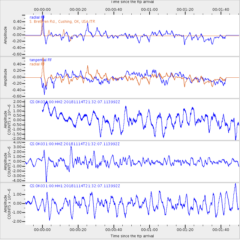
OK031 S. Brethren Rd., Cushing, OK, USA - Earthquake Result Viewer
*The percent match for this event was below the threshold and hence no stack was calculated.
| Earthquake location: |
Near East Coast Of Kamchatka |
| Earthquake latitude/longitude: |
55.6/162.0 |
| Earthquake time(UTC): |
2018/11/14 (318) 21:21:50 GMT |
| Earthquake Depth: |
50 km |
| Earthquake Magnitude: |
6.1 Mww |
| Earthquake Catalog/Contributor: |
NEIC PDE/us |
|
| Network: |
GS US Geological Survey Networks |
| Station: |
OK031 S. Brethren Rd., Cushing, OK, USA |
| Lat/Lon: |
35.95 N/96.84 W |
| Elevation: |
290 m |
|
| Distance: |
66.9 deg |
| Az: |
59.933 deg |
| Baz: |
322.78 deg |
| Ray Param: |
$rayparam |
*The percent match for this event was below the threshold and hence was not used in the summary stack. |
|
| Radial Match: |
54.23088 % |
| Radial Bump: |
400 |
| Transverse Match: |
46.266357 % |
| Transverse Bump: |
400 |
| SOD ConfigId: |
3165032 |
| Insert Time: |
2018-11-28 21:33:35.912 +0000 |
| GWidth: |
2.5 |
| Max Bumps: |
400 |
| Tol: |
0.001 |
|
Signal To Noise
| Channel | StoN | STA | LTA |
| GS:OK031:00:HHZ:20181114T21:32:07.113992Z | 5.547847 | 1.5631317E-6 | 2.8175467E-7 |
| GS:OK031:00:HH1:20181114T21:32:07.113992Z | 1.7628548 | 1.0057146E-6 | 5.705034E-7 |
| GS:OK031:00:HH2:20181114T21:32:07.113992Z | 1.619307 | 1.0180647E-6 | 6.2870396E-7 |
| Arrivals |
| Ps | |
| PpPs | |
| PsPs/PpSs | |


