You are here: Home > Network List > TA - USArray Transportable Network (new EarthScope stations) Stations List
> Station F22A Rosebud, MT, USA > Earthquake Result Viewer
F22A Rosebud, MT, USA - Earthquake Result Viewer
*The percent match for this event was below the threshold and hence no stack was calculated.
| Earthquake location: |
Northern Mid-Atlantic Ridge |
| Earthquake latitude/longitude: |
35.3/-35.9 |
| Earthquake time(UTC): |
2010/05/25 (145) 10:09:05 GMT |
| Earthquake Depth: |
10 km |
| Earthquake Magnitude: |
5.5 MB, 5.5 MS, 6.3 MW, 6.3 MW |
| Earthquake Catalog/Contributor: |
WHDF/NEIC |
|
| Network: |
TA USArray Transportable Network (new EarthScope stations) |
| Station: |
F22A Rosebud, MT, USA |
| Lat/Lon: |
45.78 N/106.26 W |
| Elevation: |
882 m |
|
| Distance: |
52.9 deg |
| Az: |
304.233 deg |
| Baz: |
74.993 deg |
| Ray Param: |
$rayparam |
*The percent match for this event was below the threshold and hence was not used in the summary stack. |
|
| Radial Match: |
52.47721 % |
| Radial Bump: |
386 |
| Transverse Match: |
42.208607 % |
| Transverse Bump: |
391 |
| SOD ConfigId: |
314592 |
| Insert Time: |
2010-09-14 06:38:49.805 +0000 |
| GWidth: |
2.5 |
| Max Bumps: |
400 |
| Tol: |
0.001 |
|
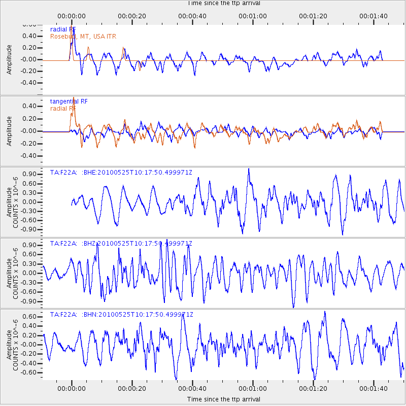
Signal To Noise
| Channel | StoN | STA | LTA |
| TA:F22A: :BHZ:20100525T10:17:50.499971Z | 2.563744 | 3.167661E-7 | 1.2355606E-7 |
| TA:F22A: :BHN:20100525T10:17:50.499971Z | 0.8648903 | 2.0314224E-7 | 2.348763E-7 |
| TA:F22A: :BHE:20100525T10:17:50.499971Z | 0.6585062 | 2.031907E-7 | 3.0856305E-7 |
| Arrivals |
| Ps | |
| PpPs | |
| PsPs/PpSs | |


