You are here: Home > Network List > TA - USArray Transportable Network (new EarthScope stations) Stations List
> Station I28A Midland, SD, USA > Earthquake Result Viewer
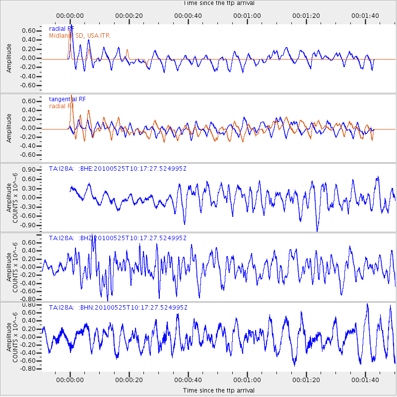
I28A Midland, SD, USA - Earthquake Result Viewer
*The percent match for this event was below the threshold and hence no stack was calculated.
| Earthquake location: |
Northern Mid-Atlantic Ridge |
| Earthquake latitude/longitude: |
35.3/-35.9 |
| Earthquake time(UTC): |
2010/05/25 (145) 10:09:05 GMT |
| Earthquake Depth: |
10 km |
| Earthquake Magnitude: |
5.5 MB, 5.5 MS, 6.3 MW, 6.3 MW |
| Earthquake Catalog/Contributor: |
WHDF/NEIC |
|
| Network: |
TA USArray Transportable Network (new EarthScope stations) |
| Station: |
I28A Midland, SD, USA |
| Lat/Lon: |
44.00 N/101.17 W |
| Elevation: |
655 m |
|
| Distance: |
49.8 deg |
| Az: |
300.884 deg |
| Baz: |
76.479 deg |
| Ray Param: |
$rayparam |
*The percent match for this event was below the threshold and hence was not used in the summary stack. |
|
| Radial Match: |
62.582634 % |
| Radial Bump: |
400 |
| Transverse Match: |
44.05406 % |
| Transverse Bump: |
400 |
| SOD ConfigId: |
314592 |
| Insert Time: |
2010-09-14 06:43:02.378 +0000 |
| GWidth: |
2.5 |
| Max Bumps: |
400 |
| Tol: |
0.001 |
|
Signal To Noise
| Channel | StoN | STA | LTA |
| TA:I28A: :BHZ:20100525T10:17:27.524995Z | 2.5720677 | 2.7546054E-7 | 1.0709692E-7 |
| TA:I28A: :BHN:20100525T10:17:27.524995Z | 0.7320356 | 1.6481329E-7 | 2.2514382E-7 |
| TA:I28A: :BHE:20100525T10:17:27.524995Z | 0.9524349 | 1.7985222E-7 | 1.8883415E-7 |
| Arrivals |
| Ps | |
| PpPs | |
| PsPs/PpSs | |


