You are here: Home > Network List > IW - Intermountain West Stations List
> Station MOOW Moose Ponds, Wyoming, USA > Earthquake Result Viewer
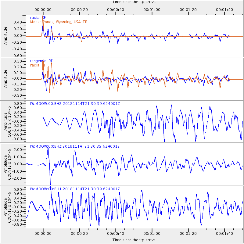
MOOW Moose Ponds, Wyoming, USA - Earthquake Result Viewer
*The percent match for this event was below the threshold and hence no stack was calculated.
| Earthquake location: |
Near East Coast Of Kamchatka |
| Earthquake latitude/longitude: |
55.6/162.0 |
| Earthquake time(UTC): |
2018/11/14 (318) 21:21:50 GMT |
| Earthquake Depth: |
50 km |
| Earthquake Magnitude: |
6.1 Mww |
| Earthquake Catalog/Contributor: |
NEIC PDE/us |
|
| Network: |
IW Intermountain West |
| Station: |
MOOW Moose Ponds, Wyoming, USA |
| Lat/Lon: |
43.75 N/110.74 W |
| Elevation: |
2128 m |
|
| Distance: |
54.0 deg |
| Az: |
63.42 deg |
| Baz: |
315.588 deg |
| Ray Param: |
$rayparam |
*The percent match for this event was below the threshold and hence was not used in the summary stack. |
|
| Radial Match: |
73.15728 % |
| Radial Bump: |
400 |
| Transverse Match: |
63.898422 % |
| Transverse Bump: |
400 |
| SOD ConfigId: |
3165032 |
| Insert Time: |
2018-11-28 21:35:00.479 +0000 |
| GWidth: |
2.5 |
| Max Bumps: |
400 |
| Tol: |
0.001 |
|
Signal To Noise
| Channel | StoN | STA | LTA |
| IW:MOOW:00:BHZ:20181114T21:30:39.624001Z | 6.1851525 | 1.2324932E-6 | 1.9926642E-7 |
| IW:MOOW:00:BH1:20181114T21:30:39.624001Z | 1.7576947 | 3.7006163E-7 | 2.1053805E-7 |
| IW:MOOW:00:BH2:20181114T21:30:39.624001Z | 1.8318088 | 3.1780647E-7 | 1.7349325E-7 |
| Arrivals |
| Ps | |
| PpPs | |
| PsPs/PpSs | |


