You are here: Home > Network List > US - United States National Seismic Network Stations List
> Station DGMT Dagmar, Montana, USA > Earthquake Result Viewer
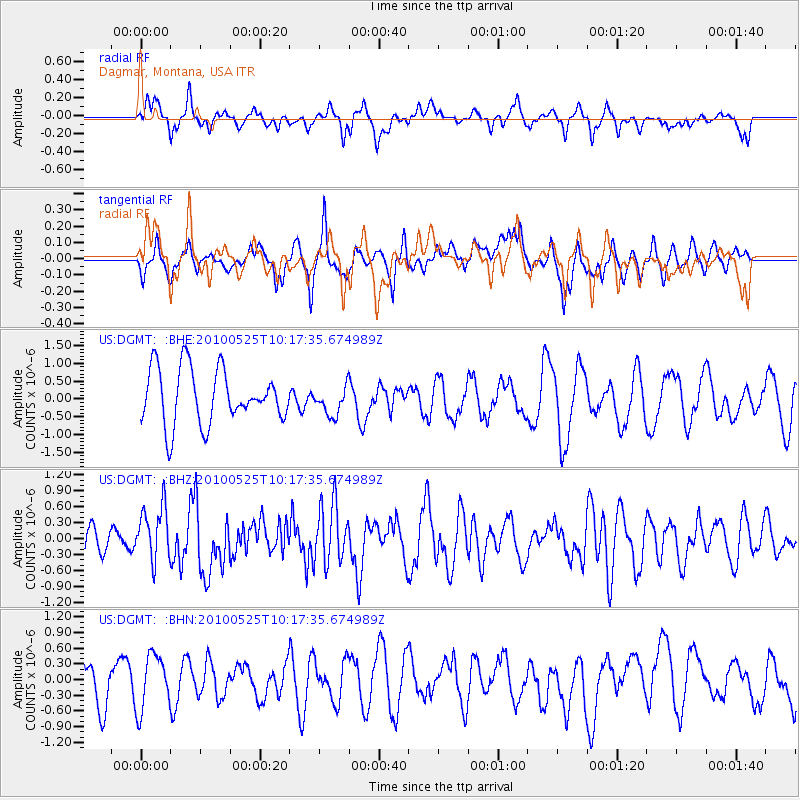
DGMT Dagmar, Montana, USA - Earthquake Result Viewer
*The percent match for this event was below the threshold and hence no stack was calculated.
| Earthquake location: |
Northern Mid-Atlantic Ridge |
| Earthquake latitude/longitude: |
35.3/-35.9 |
| Earthquake time(UTC): |
2010/05/25 (145) 10:09:05 GMT |
| Earthquake Depth: |
10 km |
| Earthquake Magnitude: |
5.5 MB, 5.5 MS, 6.3 MW, 6.3 MW |
| Earthquake Catalog/Contributor: |
WHDF/NEIC |
|
| Network: |
US United States National Seismic Network |
| Station: |
DGMT Dagmar, Montana, USA |
| Lat/Lon: |
48.47 N/104.20 W |
| Elevation: |
0.0 m |
|
| Distance: |
50.9 deg |
| Az: |
307.149 deg |
| Baz: |
78.302 deg |
| Ray Param: |
$rayparam |
*The percent match for this event was below the threshold and hence was not used in the summary stack. |
|
| Radial Match: |
43.201756 % |
| Radial Bump: |
331 |
| Transverse Match: |
50.264435 % |
| Transverse Bump: |
364 |
| SOD ConfigId: |
314592 |
| Insert Time: |
2010-09-14 06:49:52.772 +0000 |
| GWidth: |
2.5 |
| Max Bumps: |
400 |
| Tol: |
0.001 |
|
Signal To Noise
| Channel | StoN | STA | LTA |
| US:DGMT: :BHZ:20100525T10:17:35.674989Z | 2.6104615 | 5.1811634E-7 | 1.9847691E-7 |
| US:DGMT: :BHN:20100525T10:17:35.674989Z | 1.1295255 | 5.2600893E-7 | 4.6569016E-7 |
| US:DGMT: :BHE:20100525T10:17:35.674989Z | 0.54426146 | 4.1771142E-7 | 7.6748296E-7 |
| Arrivals |
| Ps | |
| PpPs | |
| PsPs/PpSs | |


