MDM Murphy Dome - Earthquake Result Viewer
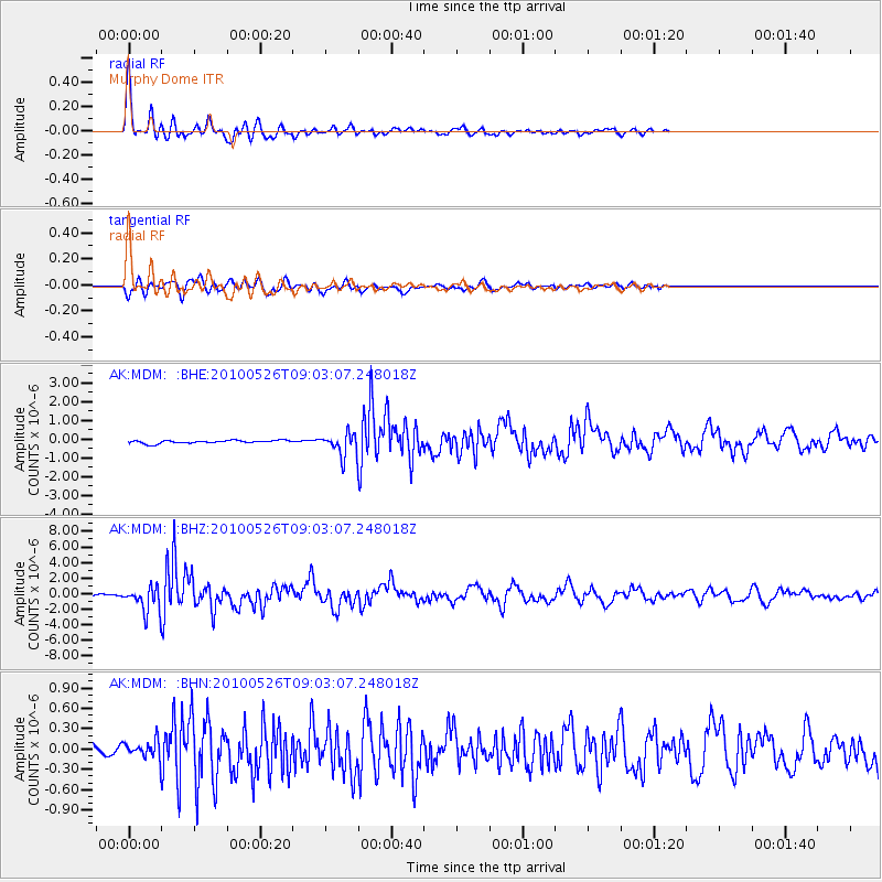
Earthquake location: Southeast Of Ryukyu Islands
Earthquake latitude/longitude: 25.8/129.9
Earthquake time(UTC): 2010/05/26 (146) 08:53:08 GMT
Earthquake Depth: 10 km
Earthquake Magnitude: 6.2 MB, 6.2 MS, 6.5 MW, 6.5 MW
Earthquake Catalog/Contributor: WHDF/NEIC
Network: AK Alaska Regional Network
Station: MDM Murphy Dome
Lat/Lon: 64.96 N/148.23 W
Elevation: 634 m
Distance: 63.5 deg
Az: 28.077 deg
Baz: 274.361 deg
Ray Param: 0.059523523
Estimated Moho Depth: 31.25 km
Estimated Crust Vp/Vs: 1.70
Assumed Crust Vp: 6.566 km/s
Estimated Crust Vs: 3.868 km/s
Estimated Crust Poisson's Ratio: 0.23
Radial Match: 96.69195 %
Radial Bump: 381
Transverse Match: 82.03567 %
Transverse Bump: 400
SOD ConfigId: 314592
Insert Time: 2010-09-14 06:51:54.790 +0000
GWidth: 2.5
Max Bumps: 400
Tol: 0.001

Signal To Noise

ChannelStoNSTALTA
AK:MDM: :BHZ:20100526T09:03:07.248018Z15.1400721.5204829E-61.0042772E-7
AK:MDM: :BHN:20100526T09:03:07.248018Z1.02875171.4366098E-71.3964592E-7
AK:MDM: :BHE:20100526T09:03:07.248018Z7.1368895.679545E-77.9580126E-8
Arrivals
Ps3.5 SECOND
PpPs12 SECOND
PsPs/PpSs16 SECOND