You are here: Home > Network List > CI - Caltech Regional Seismic Network Stations List
> Station VTV Victorville, California, USA > Earthquake Result Viewer
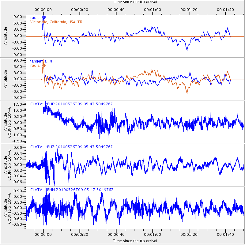
VTV Victorville, California, USA - Earthquake Result Viewer
*The percent match for this event was below the threshold and hence no stack was calculated.
| Earthquake location: |
Southeast Of Ryukyu Islands |
| Earthquake latitude/longitude: |
25.8/129.9 |
| Earthquake time(UTC): |
2010/05/26 (146) 08:53:08 GMT |
| Earthquake Depth: |
10 km |
| Earthquake Magnitude: |
6.2 MB, 6.2 MS, 6.5 MW, 6.5 MW |
| Earthquake Catalog/Contributor: |
WHDF/NEIC |
|
| Network: |
CI Caltech Regional Seismic Network |
| Station: |
VTV Victorville, California, USA |
| Lat/Lon: |
34.56 N/117.33 W |
| Elevation: |
812 m |
|
| Distance: |
92.5 deg |
| Az: |
49.635 deg |
| Baz: |
303.65 deg |
| Ray Param: |
$rayparam |
*The percent match for this event was below the threshold and hence was not used in the summary stack. |
|
| Radial Match: |
27.286242 % |
| Radial Bump: |
400 |
| Transverse Match: |
41.59941 % |
| Transverse Bump: |
400 |
| SOD ConfigId: |
314592 |
| Insert Time: |
2010-09-14 06:56:00.659 +0000 |
| GWidth: |
2.5 |
| Max Bumps: |
400 |
| Tol: |
0.001 |
|
Signal To Noise
| Channel | StoN | STA | LTA |
| CI:VTV: :BHZ:20100526T09:05:47.504976Z | 3.5255527 | 2.6857933E-8 | 7.618077E-9 |
| CI:VTV: :BHN:20100526T09:05:47.504976Z | 1.3803024 | 4.219279E-7 | 3.0567787E-7 |
| CI:VTV: :BHE:20100526T09:05:47.504976Z | 1.2899798 | 6.7268985E-7 | 5.2147317E-7 |
| Arrivals |
| Ps | |
| PpPs | |
| PsPs/PpSs | |


