
LSA Tibet, China - Earthquake Result Viewer
| ||||||||||||||||||
| ||||||||||||||||||
| ||||||||||||||||||
|
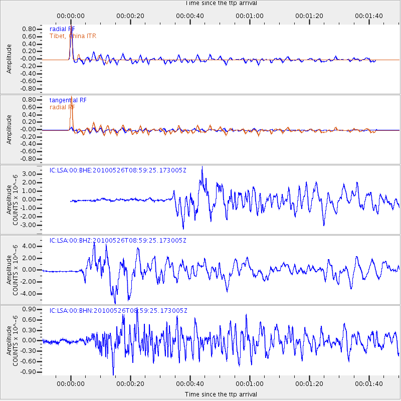
Signal To Noise
| Channel | StoN | STA | LTA |
| IC:LSA:00:BHZ:20100526T08:59:25.173005Z | 6.105608 | 4.7624906E-7 | 7.8001904E-8 |
| IC:LSA:00:BHN:20100526T08:59:25.173005Z | 1.3224325 | 3.6911768E-8 | 2.7912021E-8 |
| IC:LSA:00:BHE:20100526T08:59:25.173005Z | 3.240532 | 2.7384314E-7 | 8.4505615E-8 |
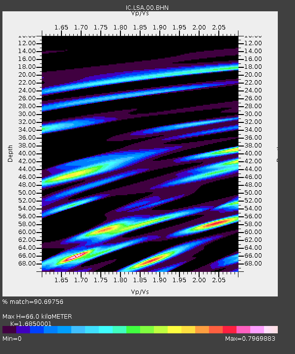
| Arrivals | |
| Ps | 7.5 SECOND |
| PpPs | 25 SECOND |
| PsPs/PpSs | 33 SECOND |

