KIV Kislovodsk, Russia - Earthquake Result Viewer
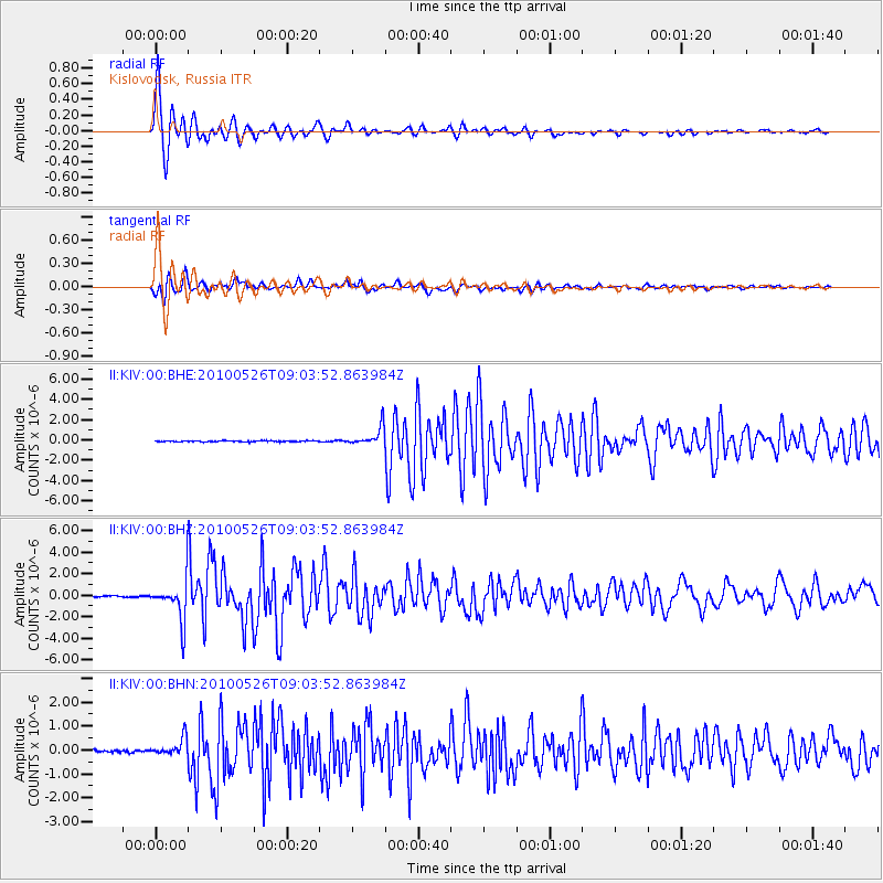
Earthquake location: Southeast Of Ryukyu Islands
Earthquake latitude/longitude: 25.8/129.9
Earthquake time(UTC): 2010/05/26 (146) 08:53:08 GMT
Earthquake Depth: 10 km
Earthquake Magnitude: 6.2 MB, 6.2 MS, 6.5 MW, 6.5 MW
Earthquake Catalog/Contributor: WHDF/NEIC
Network: II Global Seismograph Network (GSN - IRIS/IDA)
Station: KIV Kislovodsk, Russia
Lat/Lon: 43.96 N/42.69 E
Elevation: 1054 m
Distance: 70.7 deg
Az: 310.158 deg
Baz: 72.586 deg
Ray Param: 0.054799248
Estimated Moho Depth: 47.75 km
Estimated Crust Vp/Vs: 1.75
Assumed Crust Vp: 6.247 km/s
Estimated Crust Vs: 3.58 km/s
Estimated Crust Poisson's Ratio: 0.26
Radial Match: 98.60055 %
Radial Bump: 302
Transverse Match: 93.05824 %
Transverse Bump: 400
SOD ConfigId: 314592
Insert Time: 2010-09-14 06:59:17.508 +0000
GWidth: 2.5
Max Bumps: 400
Tol: 0.001

Signal To Noise

ChannelStoNSTALTA
II:KIV:00:BHZ:20100526T09:03:52.863984Z33.8916361.9449421E-65.7387087E-8
II:KIV:00:BHN:20100526T09:03:52.863984Z6.47510773.6743543E-75.6745844E-8
II:KIV:00:BHE:20100526T09:03:52.863984Z18.094819.3351736E-75.159034E-8
Arrivals
Ps5.9 SECOND
PpPs20 SECOND
PsPs/PpSs26 SECOND