ARU Arti, Russia - Earthquake Result Viewer
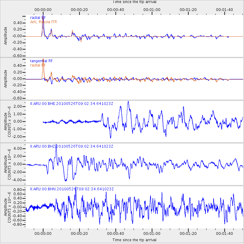
Earthquake location: Southeast Of Ryukyu Islands
Earthquake latitude/longitude: 25.8/129.9
Earthquake time(UTC): 2010/05/26 (146) 08:53:08 GMT
Earthquake Depth: 10 km
Earthquake Magnitude: 6.2 MB, 6.2 MS, 6.5 MW, 6.5 MW
Earthquake Catalog/Contributor: WHDF/NEIC
Network: II Global Seismograph Network (GSN - IRIS/IDA)
Station: ARU Arti, Russia
Lat/Lon: 56.43 N/58.56 E
Elevation: 260 m
Distance: 58.7 deg
Az: 321.966 deg
Baz: 89.94 deg
Ray Param: 0.06267218
Estimated Moho Depth: 39.5 km
Estimated Crust Vp/Vs: 1.68
Assumed Crust Vp: 6.159 km/s
Estimated Crust Vs: 3.666 km/s
Estimated Crust Poisson's Ratio: 0.23
Radial Match: 97.586586 %
Radial Bump: 323
Transverse Match: 85.8683 %
Transverse Bump: 400
SOD ConfigId: 314592
Insert Time: 2010-09-14 06:59:26.623 +0000
GWidth: 2.5
Max Bumps: 400
Tol: 0.001

Signal To Noise

ChannelStoNSTALTA
II:ARU:00:BHZ:20100526T09:02:34.641023Z12.9906819.797268E-77.541767E-8
II:ARU:00:BHN:20100526T09:02:34.641023Z1.5632671.2021353E-77.689891E-8
II:ARU:00:BHE:20100526T09:02:34.641023Z4.45983654.35145E-79.7569725E-8
Arrivals
Ps4.6 SECOND
PpPs16 SECOND
PsPs/PpSs21 SECOND