You are here: Home > Network List > US - United States National Seismic Network Stations List
> Station CBKS Cedar Bluff, Kansas, USA > Earthquake Result Viewer
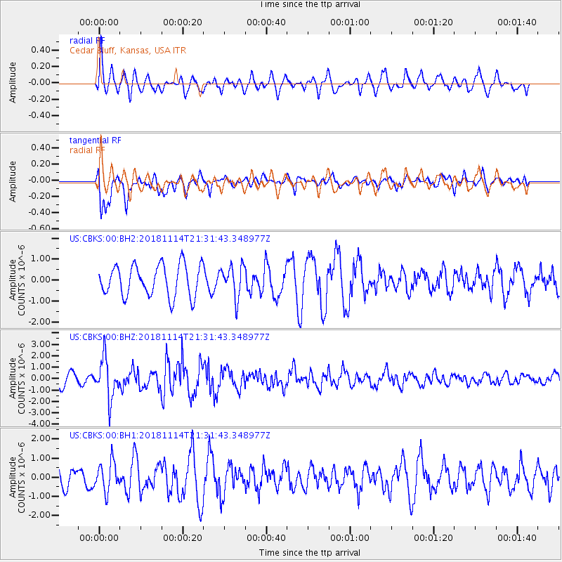
CBKS Cedar Bluff, Kansas, USA - Earthquake Result Viewer
*The percent match for this event was below the threshold and hence no stack was calculated.
| Earthquake location: |
Near East Coast Of Kamchatka |
| Earthquake latitude/longitude: |
55.6/162.0 |
| Earthquake time(UTC): |
2018/11/14 (318) 21:21:50 GMT |
| Earthquake Depth: |
50 km |
| Earthquake Magnitude: |
6.1 Mww |
| Earthquake Catalog/Contributor: |
NEIC PDE/us |
|
| Network: |
US United States National Seismic Network |
| Station: |
CBKS Cedar Bluff, Kansas, USA |
| Lat/Lon: |
38.81 N/99.74 W |
| Elevation: |
677 m |
|
| Distance: |
63.2 deg |
| Az: |
59.995 deg |
| Baz: |
321.053 deg |
| Ray Param: |
$rayparam |
*The percent match for this event was below the threshold and hence was not used in the summary stack. |
|
| Radial Match: |
64.15383 % |
| Radial Bump: |
400 |
| Transverse Match: |
66.07551 % |
| Transverse Bump: |
400 |
| SOD ConfigId: |
3165032 |
| Insert Time: |
2018-11-28 21:38:18.155 +0000 |
| GWidth: |
2.5 |
| Max Bumps: |
400 |
| Tol: |
0.001 |
|
Signal To Noise
| Channel | StoN | STA | LTA |
| US:CBKS:00:BHZ:20181114T21:31:43.348977Z | 3.5915048 | 1.7855643E-6 | 4.971633E-7 |
| US:CBKS:00:BH1:20181114T21:31:43.348977Z | 1.931075 | 7.774627E-7 | 4.0260616E-7 |
| US:CBKS:00:BH2:20181114T21:31:43.348977Z | 1.02849 | 7.6807765E-7 | 7.468013E-7 |
| Arrivals |
| Ps | |
| PpPs | |
| PsPs/PpSs | |


