You are here: Home > Network List > US - United States National Seismic Network Stations List
> Station DGMT Dagmar, Montana, USA > Earthquake Result Viewer
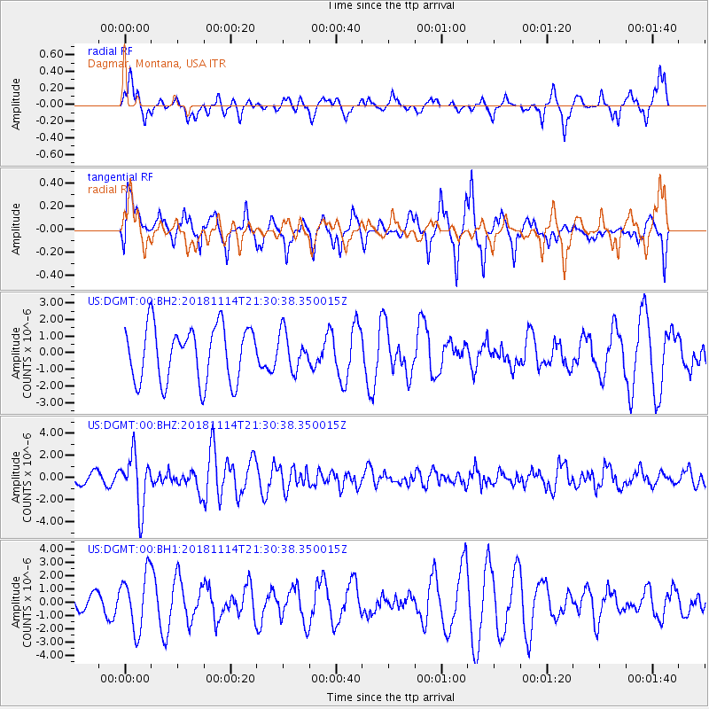
DGMT Dagmar, Montana, USA - Earthquake Result Viewer
*The percent match for this event was below the threshold and hence no stack was calculated.
| Earthquake location: |
Near East Coast Of Kamchatka |
| Earthquake latitude/longitude: |
55.6/162.0 |
| Earthquake time(UTC): |
2018/11/14 (318) 21:21:50 GMT |
| Earthquake Depth: |
50 km |
| Earthquake Magnitude: |
6.1 Mww |
| Earthquake Catalog/Contributor: |
NEIC PDE/us |
|
| Network: |
US United States National Seismic Network |
| Station: |
DGMT Dagmar, Montana, USA |
| Lat/Lon: |
48.47 N/104.20 W |
| Elevation: |
0.0 m |
|
| Distance: |
53.9 deg |
| Az: |
55.31 deg |
| Baz: |
315.521 deg |
| Ray Param: |
$rayparam |
*The percent match for this event was below the threshold and hence was not used in the summary stack. |
|
| Radial Match: |
42.127964 % |
| Radial Bump: |
317 |
| Transverse Match: |
58.94161 % |
| Transverse Bump: |
317 |
| SOD ConfigId: |
3165032 |
| Insert Time: |
2018-11-28 21:38:23.937 +0000 |
| GWidth: |
2.5 |
| Max Bumps: |
400 |
| Tol: |
0.001 |
|
Signal To Noise
| Channel | StoN | STA | LTA |
| US:DGMT:00:BHZ:20181114T21:30:38.350015Z | 5.820234 | 2.3789169E-6 | 4.0873218E-7 |
| US:DGMT:00:BH1:20181114T21:30:38.350015Z | 3.2290194 | 2.1429316E-6 | 6.636478E-7 |
| US:DGMT:00:BH2:20181114T21:30:38.350015Z | 0.669366 | 1.10941E-6 | 1.6574043E-6 |
| Arrivals |
| Ps | |
| PpPs | |
| PsPs/PpSs | |


