BILL Bilibino, Russia - Earthquake Result Viewer
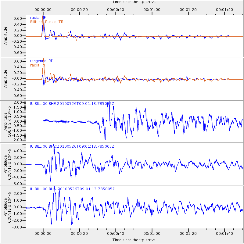
Earthquake location: Southeast Of Ryukyu Islands
Earthquake latitude/longitude: 25.8/129.9
Earthquake time(UTC): 2010/05/26 (146) 08:53:08 GMT
Earthquake Depth: 10 km
Earthquake Magnitude: 6.2 MB, 6.2 MS, 6.5 MW, 6.5 MW
Earthquake Catalog/Contributor: WHDF/NEIC
Network: IU Global Seismograph Network (GSN - IRIS/USGS)
Station: BILL Bilibino, Russia
Lat/Lon: 68.07 N/166.45 E
Elevation: 320 m
Distance: 47.7 deg
Az: 17.592 deg
Baz: 226.495 deg
Ray Param: 0.06982439
Estimated Moho Depth: 35.5 km
Estimated Crust Vp/Vs: 1.97
Assumed Crust Vp: 6.577 km/s
Estimated Crust Vs: 3.347 km/s
Estimated Crust Poisson's Ratio: 0.33
Radial Match: 96.54944 %
Radial Bump: 397
Transverse Match: 86.586624 %
Transverse Bump: 400
SOD ConfigId: 314592
Insert Time: 2010-09-14 06:59:58.300 +0000
GWidth: 2.5
Max Bumps: 400
Tol: 0.001

Signal To Noise

ChannelStoNSTALTA
IU:BILL:00:BHZ:20100526T09:01:13.785005Z36.764171.923447E-65.2318516E-8
IU:BILL:00:BHN:20100526T09:01:13.785005Z12.0540718.912083E-77.393421E-8
IU:BILL:00:BHE:20100526T09:01:13.785005Z10.317357.2790084E-77.0551145E-8
Arrivals
Ps5.5 SECOND
PpPs15 SECOND
PsPs/PpSs21 SECOND