You are here: Home > Network List > IW - Intermountain West Stations List
> Station MOOW Moose Ponds, Wyoming, USA > Earthquake Result Viewer
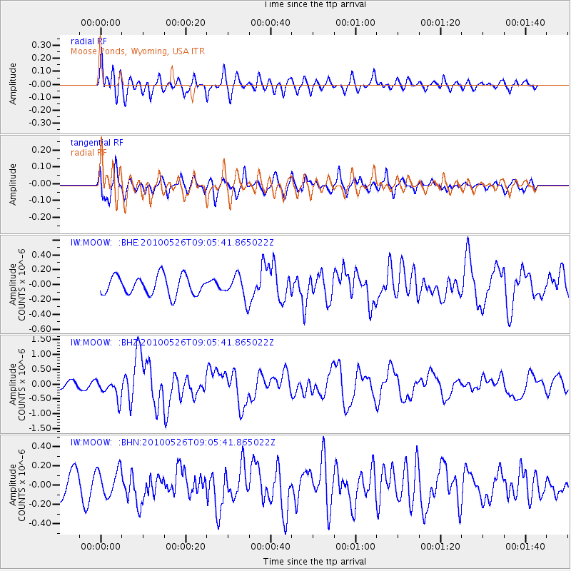
MOOW Moose Ponds, Wyoming, USA - Earthquake Result Viewer
*The percent match for this event was below the threshold and hence no stack was calculated.
| Earthquake location: |
Southeast Of Ryukyu Islands |
| Earthquake latitude/longitude: |
25.8/129.9 |
| Earthquake time(UTC): |
2010/05/26 (146) 08:53:08 GMT |
| Earthquake Depth: |
10 km |
| Earthquake Magnitude: |
6.2 MB, 6.2 MS, 6.5 MW, 6.5 MW |
| Earthquake Catalog/Contributor: |
WHDF/NEIC |
|
| Network: |
IW Intermountain West |
| Station: |
MOOW Moose Ponds, Wyoming, USA |
| Lat/Lon: |
43.75 N/110.74 W |
| Elevation: |
2128 m |
|
| Distance: |
91.3 deg |
| Az: |
39.203 deg |
| Baz: |
308.148 deg |
| Ray Param: |
$rayparam |
*The percent match for this event was below the threshold and hence was not used in the summary stack. |
|
| Radial Match: |
71.41888 % |
| Radial Bump: |
400 |
| Transverse Match: |
76.26798 % |
| Transverse Bump: |
400 |
| SOD ConfigId: |
314592 |
| Insert Time: |
2010-09-14 07:00:19.556 +0000 |
| GWidth: |
2.5 |
| Max Bumps: |
400 |
| Tol: |
0.001 |
|
Signal To Noise
| Channel | StoN | STA | LTA |
| IW:MOOW: :BHZ:20100526T09:05:41.865022Z | 2.7522285 | 3.3662906E-7 | 1.2231145E-7 |
| IW:MOOW: :BHN:20100526T09:05:41.865022Z | 1.4446796 | 1.4027562E-7 | 9.709808E-8 |
| IW:MOOW: :BHE:20100526T09:05:41.865022Z | 1.3083196 | 1.6695279E-7 | 1.2760857E-7 |
| Arrivals |
| Ps | |
| PpPs | |
| PsPs/PpSs | |


