You are here: Home > Network List > CI - Caltech Regional Seismic Network Stations List
> Station MPP McPhearson Peak > Earthquake Result Viewer
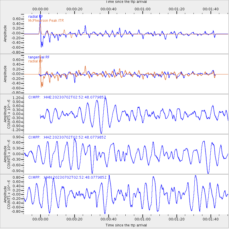
MPP McPhearson Peak - Earthquake Result Viewer
*The percent match for this event was below the threshold and hence no stack was calculated.
| Earthquake location: |
Tonga Islands Region |
| Earthquake latitude/longitude: |
-23.5/-175.6 |
| Earthquake time(UTC): |
2023/07/02 (183) 02:41:17 GMT |
| Earthquake Depth: |
10 km |
| Earthquake Magnitude: |
5.6 Mww |
| Earthquake Catalog/Contributor: |
NEIC PDE/us |
|
| Network: |
CI Caltech Regional Seismic Network |
| Station: |
MPP McPhearson Peak |
| Lat/Lon: |
34.89 N/119.81 W |
| Elevation: |
1739 m |
|
| Distance: |
78.6 deg |
| Az: |
43.908 deg |
| Baz: |
230.737 deg |
| Ray Param: |
$rayparam |
*The percent match for this event was below the threshold and hence was not used in the summary stack. |
|
| Radial Match: |
60.027637 % |
| Radial Bump: |
400 |
| Transverse Match: |
51.44942 % |
| Transverse Bump: |
347 |
| SOD ConfigId: |
30536071 |
| Insert Time: |
2023-07-16 02:53:05.042 +0000 |
| GWidth: |
2.5 |
| Max Bumps: |
400 |
| Tol: |
0.001 |
|
Signal To Noise
| Channel | StoN | STA | LTA |
| CI:MPP: :HHZ:20230702T02:52:48.077985Z | 1.9064785 | 4.2274175E-7 | 2.2173958E-7 |
| CI:MPP: :HHN:20230702T02:52:48.077985Z | 1.4309379 | 4.7026376E-7 | 3.2864023E-7 |
| CI:MPP: :HHE:20230702T02:52:48.077985Z | 2.6054199 | 6.8991096E-7 | 2.647984E-7 |
| Arrivals |
| Ps | |
| PpPs | |
| PsPs/PpSs | |


