You are here: Home > Network List > IW - Intermountain West Stations List
> Station MOOW Moose Ponds, Wyoming, USA > Earthquake Result Viewer
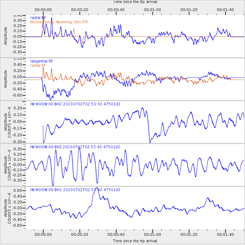
MOOW Moose Ponds, Wyoming, USA - Earthquake Result Viewer
*The percent match for this event was below the threshold and hence no stack was calculated.
| Earthquake location: |
Tonga Islands Region |
| Earthquake latitude/longitude: |
-23.5/-175.6 |
| Earthquake time(UTC): |
2023/07/02 (183) 02:41:17 GMT |
| Earthquake Depth: |
10 km |
| Earthquake Magnitude: |
5.6 Mww |
| Earthquake Catalog/Contributor: |
NEIC PDE/us |
|
| Network: |
IW Intermountain West |
| Station: |
MOOW Moose Ponds, Wyoming, USA |
| Lat/Lon: |
43.75 N/110.74 W |
| Elevation: |
2128 m |
|
| Distance: |
89.5 deg |
| Az: |
40.997 deg |
| Baz: |
236.18 deg |
| Ray Param: |
$rayparam |
*The percent match for this event was below the threshold and hence was not used in the summary stack. |
|
| Radial Match: |
44.1905 % |
| Radial Bump: |
400 |
| Transverse Match: |
28.621813 % |
| Transverse Bump: |
400 |
| SOD ConfigId: |
30536071 |
| Insert Time: |
2023-07-16 02:56:40.627 +0000 |
| GWidth: |
2.5 |
| Max Bumps: |
400 |
| Tol: |
0.001 |
|
Signal To Noise
| Channel | StoN | STA | LTA |
| IW:MOOW:00:BHZ:20230702T02:53:43.475019Z | 2.3252933 | 1.0828564E-7 | 4.6568594E-8 |
| IW:MOOW:00:BH1:20230702T02:53:43.475019Z | 1.8647027 | 1.00108885E-7 | 5.3686243E-8 |
| IW:MOOW:00:BH2:20230702T02:53:43.475019Z | 0.58589214 | 4.817213E-8 | 8.222014E-8 |
| Arrivals |
| Ps | |
| PpPs | |
| PsPs/PpSs | |


