
AQU L'Aquila, Italy - Earthquake Result Viewer
| ||||||||||||||||||
| ||||||||||||||||||
| ||||||||||||||||||
|
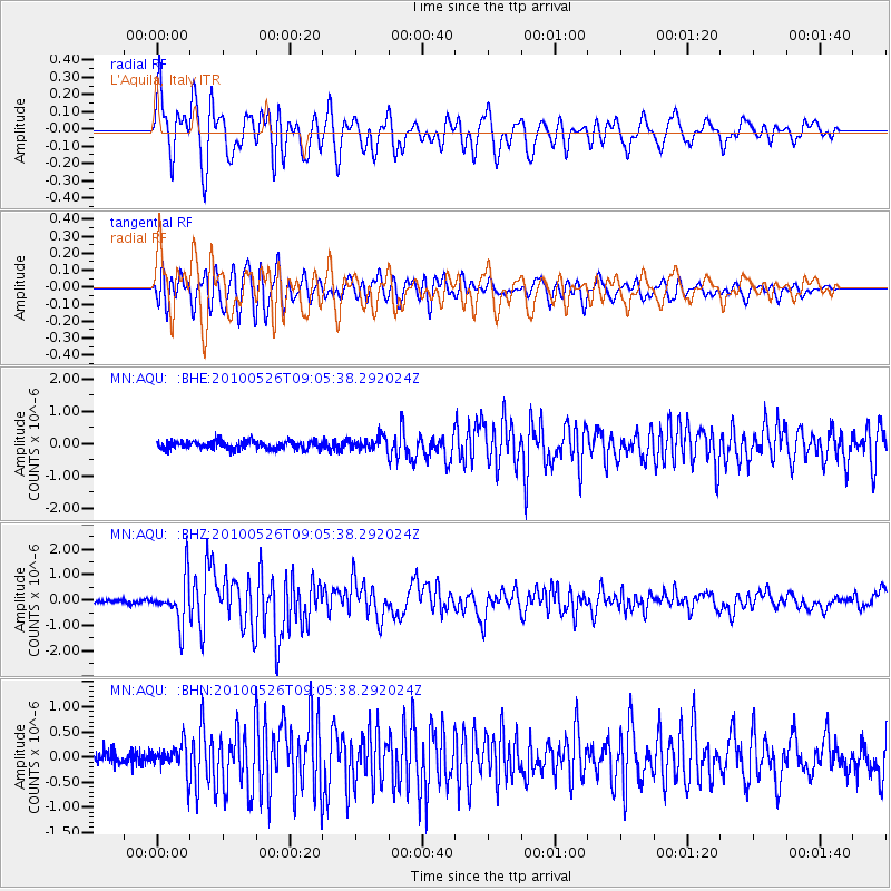
Signal To Noise
| Channel | StoN | STA | LTA |
| MN:AQU: :BHZ:20100526T09:05:38.292024Z | 13.503368 | 8.7980516E-7 | 6.5154495E-8 |
| MN:AQU: :BHN:20100526T09:05:38.292024Z | 2.764565 | 2.9004218E-7 | 1.0491423E-7 |
| MN:AQU: :BHE:20100526T09:05:38.292024Z | 1.575415 | 2.0027622E-7 | 1.2712601E-7 |
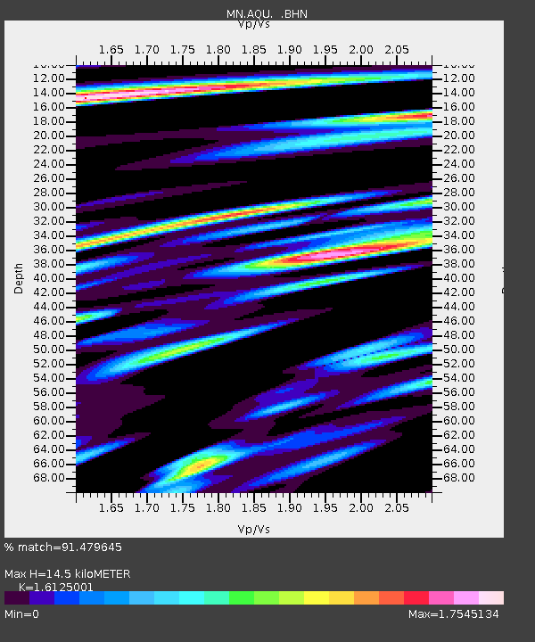
| Arrivals | |
| Ps | 1.4 SECOND |
| PpPs | 5.9 SECOND |
| PsPs/PpSs | 7.4 SECOND |

