You are here: Home > Network List > US - United States National Seismic Network Stations List
> Station NEW Newport, Washington, USA > Earthquake Result Viewer
NEW Newport, Washington, USA - Earthquake Result Viewer
*The percent match for this event was below the threshold and hence no stack was calculated.
| Earthquake location: |
Near East Coast Of Kamchatka |
| Earthquake latitude/longitude: |
55.6/162.0 |
| Earthquake time(UTC): |
2018/11/14 (318) 21:21:50 GMT |
| Earthquake Depth: |
50 km |
| Earthquake Magnitude: |
6.1 Mww |
| Earthquake Catalog/Contributor: |
NEIC PDE/us |
|
| Network: |
US United States National Seismic Network |
| Station: |
NEW Newport, Washington, USA |
| Lat/Lon: |
48.26 N/117.12 W |
| Elevation: |
760 m |
|
| Distance: |
47.7 deg |
| Az: |
63.103 deg |
| Baz: |
310.811 deg |
| Ray Param: |
$rayparam |
*The percent match for this event was below the threshold and hence was not used in the summary stack. |
|
| Radial Match: |
59.211002 % |
| Radial Bump: |
400 |
| Transverse Match: |
65.00598 % |
| Transverse Bump: |
393 |
| SOD ConfigId: |
3165032 |
| Insert Time: |
2018-11-28 21:39:07.761 +0000 |
| GWidth: |
2.5 |
| Max Bumps: |
400 |
| Tol: |
0.001 |
|
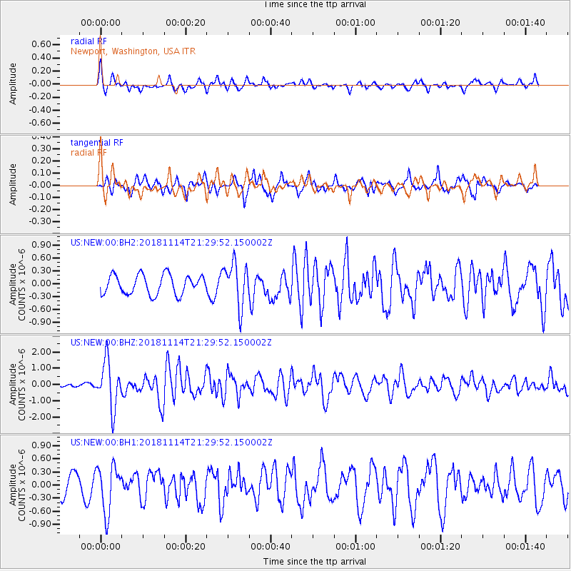
Signal To Noise
| Channel | StoN | STA | LTA |
| US:NEW:00:BHZ:20181114T21:29:52.150002Z | 5.704159 | 1.4652123E-6 | 2.568674E-7 |
| US:NEW:00:BH1:20181114T21:29:52.150002Z | 1.874023 | 5.378243E-7 | 2.8698918E-7 |
| US:NEW:00:BH2:20181114T21:29:52.150002Z | 2.2745564 | 5.1308297E-7 | 2.2557495E-7 |
| Arrivals |
| Ps | |
| PpPs | |
| PsPs/PpSs | |


