You are here: Home > Network List > US - United States National Seismic Network Stations List
> Station WMOK Wichita Mountains, Oklahoma, USA > Earthquake Result Viewer
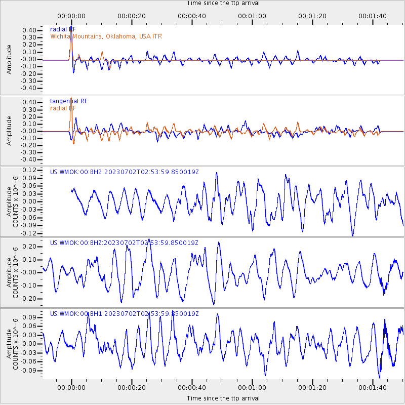
WMOK Wichita Mountains, Oklahoma, USA - Earthquake Result Viewer
*The percent match for this event was below the threshold and hence no stack was calculated.
| Earthquake location: |
Tonga Islands Region |
| Earthquake latitude/longitude: |
-23.5/-175.6 |
| Earthquake time(UTC): |
2023/07/02 (183) 02:41:17 GMT |
| Earthquake Depth: |
10 km |
| Earthquake Magnitude: |
5.6 Mww |
| Earthquake Catalog/Contributor: |
NEIC PDE/us |
|
| Network: |
US United States National Seismic Network |
| Station: |
WMOK Wichita Mountains, Oklahoma, USA |
| Lat/Lon: |
34.74 N/98.78 W |
| Elevation: |
486 m |
|
| Distance: |
93.0 deg |
| Az: |
53.414 deg |
| Baz: |
243.485 deg |
| Ray Param: |
$rayparam |
*The percent match for this event was below the threshold and hence was not used in the summary stack. |
|
| Radial Match: |
67.94895 % |
| Radial Bump: |
400 |
| Transverse Match: |
57.71925 % |
| Transverse Bump: |
400 |
| SOD ConfigId: |
30536071 |
| Insert Time: |
2023-07-16 03:04:50.969 +0000 |
| GWidth: |
2.5 |
| Max Bumps: |
400 |
| Tol: |
0.001 |
|
Signal To Noise
| Channel | StoN | STA | LTA |
| US:WMOK:00:BHZ:20230702T02:53:59.850019Z | 0.8631868 | 5.1132464E-8 | 5.9236847E-8 |
| US:WMOK:00:BH1:20230702T02:53:59.850019Z | 1.0178885 | 3.073797E-8 | 3.0197775E-8 |
| US:WMOK:00:BH2:20230702T02:53:59.850019Z | 1.0016731 | 3.3010327E-8 | 3.2955185E-8 |
| Arrivals |
| Ps | |
| PpPs | |
| PsPs/PpSs | |


