You are here: Home > Network List > TA - USArray Transportable Network (new EarthScope stations) Stations List
> Station I20A Worland, WY, USA > Earthquake Result Viewer
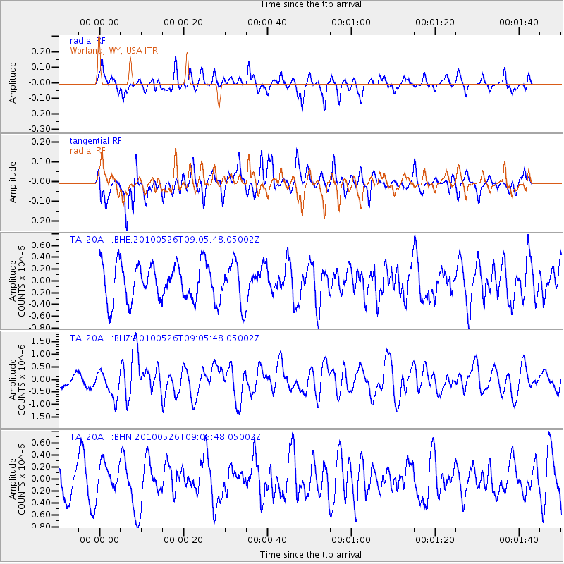
I20A Worland, WY, USA - Earthquake Result Viewer
*The percent match for this event was below the threshold and hence no stack was calculated.
| Earthquake location: |
Southeast Of Ryukyu Islands |
| Earthquake latitude/longitude: |
25.8/129.9 |
| Earthquake time(UTC): |
2010/05/26 (146) 08:53:08 GMT |
| Earthquake Depth: |
10 km |
| Earthquake Magnitude: |
6.2 MB, 6.2 MS, 6.5 MW, 6.5 MW |
| Earthquake Catalog/Contributor: |
WHDF/NEIC |
|
| Network: |
TA USArray Transportable Network (new EarthScope stations) |
| Station: |
I20A Worland, WY, USA |
| Lat/Lon: |
43.95 N/108.13 W |
| Elevation: |
1342 m |
|
| Distance: |
92.6 deg |
| Az: |
37.853 deg |
| Baz: |
310.0 deg |
| Ray Param: |
$rayparam |
*The percent match for this event was below the threshold and hence was not used in the summary stack. |
|
| Radial Match: |
45.102764 % |
| Radial Bump: |
369 |
| Transverse Match: |
49.037006 % |
| Transverse Bump: |
400 |
| SOD ConfigId: |
314592 |
| Insert Time: |
2010-09-14 07:05:51.782 +0000 |
| GWidth: |
2.5 |
| Max Bumps: |
400 |
| Tol: |
0.001 |
|
Signal To Noise
| Channel | StoN | STA | LTA |
| TA:I20A: :BHZ:20100526T09:05:48.05002Z | 2.9539604 | 5.4033353E-7 | 1.8291833E-7 |
| TA:I20A: :BHN:20100526T09:05:48.05002Z | 0.7914987 | 2.4257469E-7 | 3.0647513E-7 |
| TA:I20A: :BHE:20100526T09:05:48.05002Z | 1.1793226 | 3.613674E-7 | 3.0641945E-7 |
| Arrivals |
| Ps | |
| PpPs | |
| PsPs/PpSs | |


