You are here: Home > Network List > UU - University of Utah Regional Network Stations List
> Station KNB Kanab, UT, USA > Earthquake Result Viewer
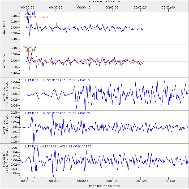
KNB Kanab, UT, USA - Earthquake Result Viewer
*The percent match for this event was below the threshold and hence no stack was calculated.
| Earthquake location: |
Near East Coast Of Kamchatka |
| Earthquake latitude/longitude: |
55.6/162.0 |
| Earthquake time(UTC): |
2018/11/14 (318) 21:21:50 GMT |
| Earthquake Depth: |
50 km |
| Earthquake Magnitude: |
6.1 Mww |
| Earthquake Catalog/Contributor: |
NEIC PDE/us |
|
| Network: |
UU University of Utah Regional Network |
| Station: |
KNB Kanab, UT, USA |
| Lat/Lon: |
37.02 N/112.82 W |
| Elevation: |
1715 m |
|
| Distance: |
57.9 deg |
| Az: |
70.367 deg |
| Baz: |
318.14 deg |
| Ray Param: |
$rayparam |
*The percent match for this event was below the threshold and hence was not used in the summary stack. |
|
| Radial Match: |
76.82701 % |
| Radial Bump: |
344 |
| Transverse Match: |
71.98064 % |
| Transverse Bump: |
333 |
| SOD ConfigId: |
3165032 |
| Insert Time: |
2018-11-28 21:39:57.021 +0000 |
| GWidth: |
2.5 |
| Max Bumps: |
400 |
| Tol: |
0.001 |
|
Signal To Noise
| Channel | StoN | STA | LTA |
| UU:KNB:01:HHZ:20181114T21:31:06.915017Z | 17.680176 | 6.7971406E-8 | 3.844498E-9 |
| UU:KNB:01:HHN:20181114T21:31:06.915017Z | 4.0189066 | 2.9687582E-8 | 7.38698E-9 |
| UU:KNB:01:HHE:20181114T21:31:06.915017Z | 2.132309 | 1.6818712E-8 | 7.887559E-9 |
| Arrivals |
| Ps | |
| PpPs | |
| PsPs/PpSs | |


