You are here: Home > Network List > TA - USArray Transportable Network (new EarthScope stations) Stations List
> Station E23A Ismay, MT, USA > Earthquake Result Viewer
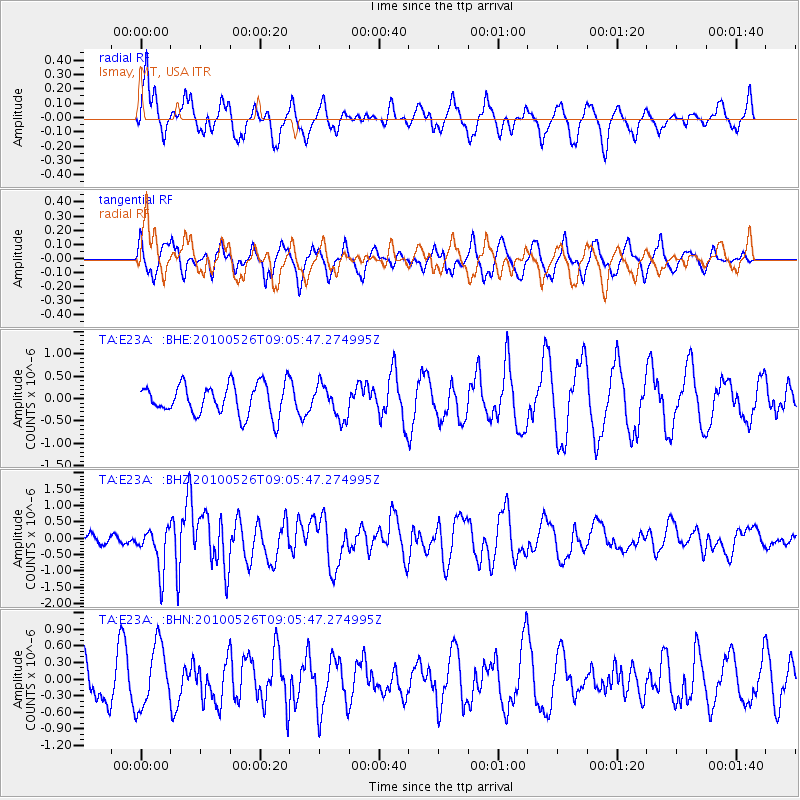
E23A Ismay, MT, USA - Earthquake Result Viewer
*The percent match for this event was below the threshold and hence no stack was calculated.
| Earthquake location: |
Southeast Of Ryukyu Islands |
| Earthquake latitude/longitude: |
25.8/129.9 |
| Earthquake time(UTC): |
2010/05/26 (146) 08:53:08 GMT |
| Earthquake Depth: |
10 km |
| Earthquake Magnitude: |
6.2 MB, 6.2 MS, 6.5 MW, 6.5 MW |
| Earthquake Catalog/Contributor: |
WHDF/NEIC |
|
| Network: |
TA USArray Transportable Network (new EarthScope stations) |
| Station: |
E23A Ismay, MT, USA |
| Lat/Lon: |
46.50 N/105.31 W |
| Elevation: |
750 m |
|
| Distance: |
92.4 deg |
| Az: |
34.619 deg |
| Baz: |
312.139 deg |
| Ray Param: |
$rayparam |
*The percent match for this event was below the threshold and hence was not used in the summary stack. |
|
| Radial Match: |
62.617714 % |
| Radial Bump: |
400 |
| Transverse Match: |
54.971848 % |
| Transverse Bump: |
400 |
| SOD ConfigId: |
314592 |
| Insert Time: |
2010-09-14 07:08:57.093 +0000 |
| GWidth: |
2.5 |
| Max Bumps: |
400 |
| Tol: |
0.001 |
|
Signal To Noise
| Channel | StoN | STA | LTA |
| TA:E23A: :BHZ:20100526T09:05:47.274995Z | 4.0965457 | 6.5971403E-7 | 1.6104154E-7 |
| TA:E23A: :BHN:20100526T09:05:47.274995Z | 1.1284453 | 5.664044E-7 | 5.0193347E-7 |
| TA:E23A: :BHE:20100526T09:05:47.274995Z | 1.076018 | 3.7036148E-7 | 3.4419637E-7 |
| Arrivals |
| Ps | |
| PpPs | |
| PsPs/PpSs | |


