You are here: Home > Network List > TA - USArray Transportable Network (new EarthScope stations) Stations List
> Station F25A Bowman, SD, USA > Earthquake Result Viewer
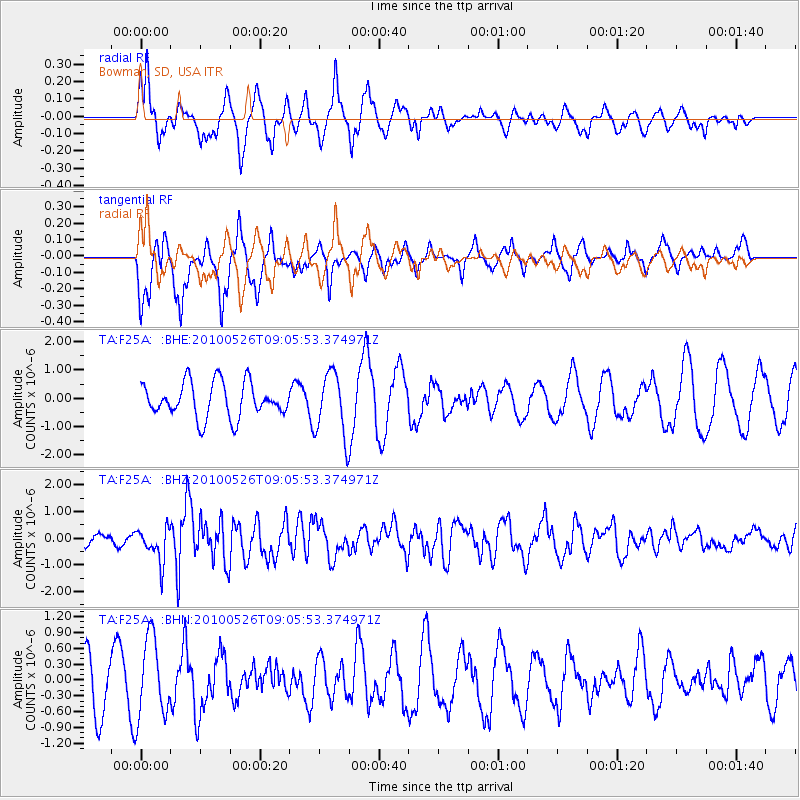
F25A Bowman, SD, USA - Earthquake Result Viewer
*The percent match for this event was below the threshold and hence no stack was calculated.
| Earthquake location: |
Southeast Of Ryukyu Islands |
| Earthquake latitude/longitude: |
25.8/129.9 |
| Earthquake time(UTC): |
2010/05/26 (146) 08:53:08 GMT |
| Earthquake Depth: |
10 km |
| Earthquake Magnitude: |
6.2 MB, 6.2 MS, 6.5 MW, 6.5 MW |
| Earthquake Catalog/Contributor: |
WHDF/NEIC |
|
| Network: |
TA USArray Transportable Network (new EarthScope stations) |
| Station: |
F25A Bowman, SD, USA |
| Lat/Lon: |
45.93 N/103.46 W |
| Elevation: |
912 m |
|
| Distance: |
93.8 deg |
| Az: |
34.166 deg |
| Baz: |
313.494 deg |
| Ray Param: |
$rayparam |
*The percent match for this event was below the threshold and hence was not used in the summary stack. |
|
| Radial Match: |
71.52003 % |
| Radial Bump: |
389 |
| Transverse Match: |
37.546345 % |
| Transverse Bump: |
312 |
| SOD ConfigId: |
314592 |
| Insert Time: |
2010-09-14 07:10:58.868 +0000 |
| GWidth: |
2.5 |
| Max Bumps: |
400 |
| Tol: |
0.001 |
|
Signal To Noise
| Channel | StoN | STA | LTA |
| TA:F25A: :BHZ:20100526T09:05:53.374971Z | 4.1597443 | 6.408733E-7 | 1.5406556E-7 |
| TA:F25A: :BHN:20100526T09:05:53.374971Z | 1.771228 | 7.5122796E-7 | 4.2412836E-7 |
| TA:F25A: :BHE:20100526T09:05:53.374971Z | 1.8380101 | 1.1242374E-6 | 6.1166014E-7 |
| Arrivals |
| Ps | |
| PpPs | |
| PsPs/PpSs | |


