You are here: Home > Network List > IU - Global Seismograph Network (GSN - IRIS/USGS) Stations List
> Station CTAO Charters Towers, Australia > Earthquake Result Viewer
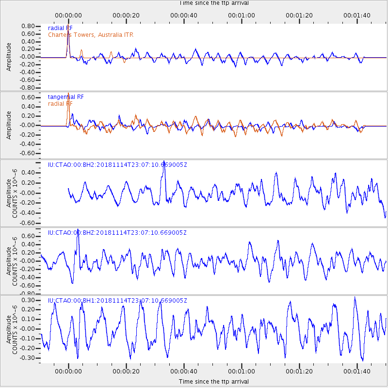
CTAO Charters Towers, Australia - Earthquake Result Viewer
*The percent match for this event was below the threshold and hence no stack was calculated.
| Earthquake location: |
Sulawesi, Indonesia |
| Earthquake latitude/longitude: |
-2.9/119.4 |
| Earthquake time(UTC): |
2018/11/14 (318) 23:01:21 GMT |
| Earthquake Depth: |
13 km |
| Earthquake Magnitude: |
5.5 Mww |
| Earthquake Catalog/Contributor: |
NEIC PDE/us |
|
| Network: |
IU Global Seismograph Network (GSN - IRIS/USGS) |
| Station: |
CTAO Charters Towers, Australia |
| Lat/Lon: |
20.09 S/146.25 E |
| Elevation: |
357 m |
|
| Distance: |
31.3 deg |
| Az: |
125.125 deg |
| Baz: |
299.647 deg |
| Ray Param: |
$rayparam |
*The percent match for this event was below the threshold and hence was not used in the summary stack. |
|
| Radial Match: |
56.204086 % |
| Radial Bump: |
400 |
| Transverse Match: |
65.46636 % |
| Transverse Bump: |
400 |
| SOD ConfigId: |
3165032 |
| Insert Time: |
2018-11-28 23:08:25.813 +0000 |
| GWidth: |
2.5 |
| Max Bumps: |
400 |
| Tol: |
0.001 |
|
Signal To Noise
| Channel | StoN | STA | LTA |
| IU:CTAO:00:BHZ:20181114T23:07:10.669005Z | 2.0944853 | 3.4287214E-7 | 1.6370234E-7 |
| IU:CTAO:00:BH1:20181114T23:07:10.669005Z | 1.4893152 | 1.6629582E-7 | 1.11659254E-7 |
| IU:CTAO:00:BH2:20181114T23:07:10.669005Z | 2.4003477 | 2.7950298E-7 | 1.1644271E-7 |
| Arrivals |
| Ps | |
| PpPs | |
| PsPs/PpSs | |


