You are here: Home > Network List > US - United States National Seismic Network Stations List
> Station WUAZ Wupatki, Arizona, USA > Earthquake Result Viewer
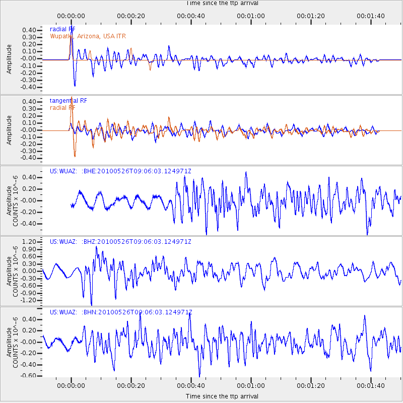
WUAZ Wupatki, Arizona, USA - Earthquake Result Viewer
*The percent match for this event was below the threshold and hence no stack was calculated.
| Earthquake location: |
Southeast Of Ryukyu Islands |
| Earthquake latitude/longitude: |
25.8/129.9 |
| Earthquake time(UTC): |
2010/05/26 (146) 08:53:08 GMT |
| Earthquake Depth: |
10 km |
| Earthquake Magnitude: |
6.2 MB, 6.2 MS, 6.5 MW, 6.5 MW |
| Earthquake Catalog/Contributor: |
WHDF/NEIC |
|
| Network: |
US United States National Seismic Network |
| Station: |
WUAZ Wupatki, Arizona, USA |
| Lat/Lon: |
35.52 N/111.37 W |
| Elevation: |
1592 m |
|
| Distance: |
95.9 deg |
| Az: |
46.014 deg |
| Baz: |
307.321 deg |
| Ray Param: |
$rayparam |
*The percent match for this event was below the threshold and hence was not used in the summary stack. |
|
| Radial Match: |
75.62198 % |
| Radial Bump: |
400 |
| Transverse Match: |
68.44781 % |
| Transverse Bump: |
400 |
| SOD ConfigId: |
314592 |
| Insert Time: |
2010-09-14 07:15:08.218 +0000 |
| GWidth: |
2.5 |
| Max Bumps: |
400 |
| Tol: |
0.001 |
|
Signal To Noise
| Channel | StoN | STA | LTA |
| US:WUAZ: :BHZ:20100526T09:06:03.124971Z | 2.4878397 | 3.3845302E-7 | 1.3604294E-7 |
| US:WUAZ: :BHN:20100526T09:06:03.124971Z | 2.0316544 | 1.1640164E-7 | 5.7294017E-8 |
| US:WUAZ: :BHE:20100526T09:06:03.124971Z | 1.5509732 | 1.2998717E-7 | 8.381007E-8 |
| Arrivals |
| Ps | |
| PpPs | |
| PsPs/PpSs | |


