You are here: Home > Network List > US - United States National Seismic Network Stations List
> Station DUG Dugway, Tooele County, Utah, USA > Earthquake Result Viewer
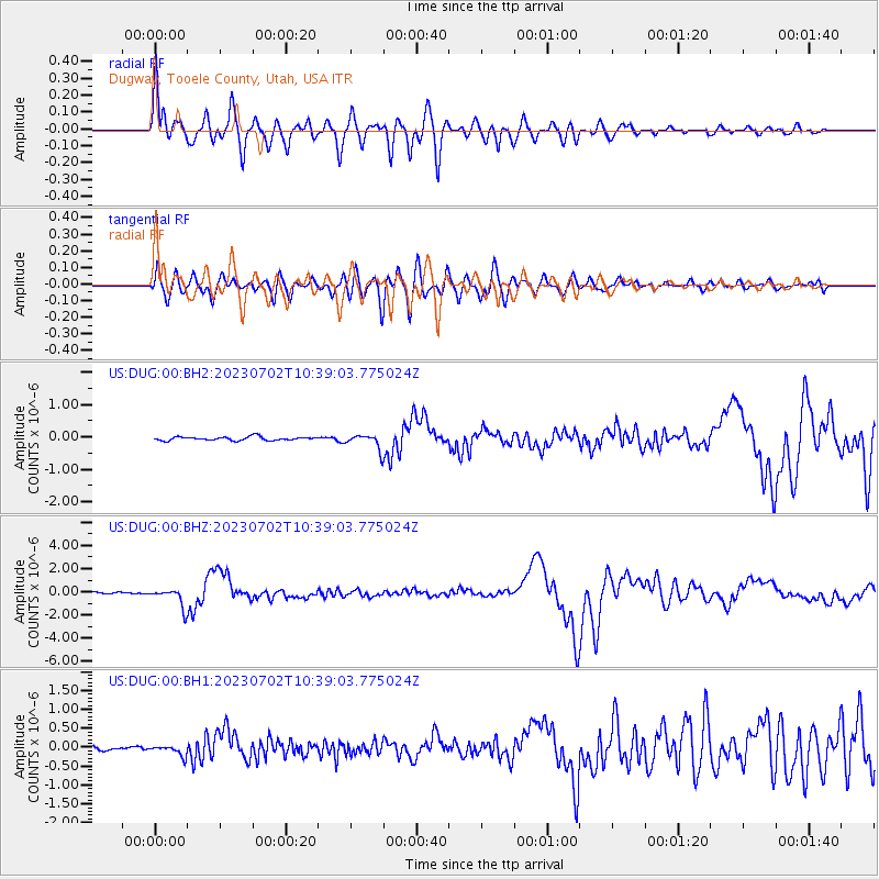
DUG Dugway, Tooele County, Utah, USA - Earthquake Result Viewer

| Earthquake location: |
Tonga Islands |
| Earthquake latitude/longitude: |
-17.9/-174.7 |
| Earthquake time(UTC): |
2023/07/02 (183) 10:27:45 GMT |
| Earthquake Depth: |
247 km |
| Earthquake Magnitude: |
6.7 Mi |
| Earthquake Catalog/Contributor: |
NEIC PDE/at |
|
| Network: |
US United States National Seismic Network |
| Station: |
DUG Dugway, Tooele County, Utah, USA |
| Lat/Lon: |
40.19 N/112.81 W |
| Elevation: |
1477 m |
|
| Distance: |
81.5 deg |
| Az: |
43.083 deg |
| Baz: |
238.116 deg |
| Ray Param: |
0.046896163 |
| Estimated Moho Depth: |
55.75 km |
| Estimated Crust Vp/Vs: |
2.06 |
| Assumed Crust Vp: |
6.276 km/s |
| Estimated Crust Vs: |
3.05 km/s |
| Estimated Crust Poisson's Ratio: |
0.35 |
|
| Radial Match: |
94.39282 % |
| Radial Bump: |
400 |
| Transverse Match: |
84.43885 % |
| Transverse Bump: |
400 |
| SOD ConfigId: |
30536071 |
| Insert Time: |
2023-07-16 11:03:56.811 +0000 |
| GWidth: |
2.5 |
| Max Bumps: |
400 |
| Tol: |
0.001 |
|
Signal To Noise
| Channel | StoN | STA | LTA |
| US:DUG:00:BHZ:20230702T10:39:03.775024Z | 12.189493 | 8.059583E-7 | 6.61191E-8 |
| US:DUG:00:BH1:20230702T10:39:03.775024Z | 2.661365 | 1.3926551E-7 | 5.23286E-8 |
| US:DUG:00:BH2:20230702T10:39:03.775024Z | 4.166297 | 2.299136E-7 | 5.5184156E-8 |
| Arrivals |
| Ps | 9.6 SECOND |
| PpPs | 27 SECOND |
| PsPs/PpSs | 36 SECOND |


