You are here: Home > Network List > CI - Caltech Regional Seismic Network Stations List
> Station SWS Sam W. Stewart, Westmorland, CA, USA > Earthquake Result Viewer
SWS Sam W. Stewart, Westmorland, CA, USA - Earthquake Result Viewer
*The percent match for this event was below the threshold and hence no stack was calculated.
| Earthquake location: |
Chile-Argentina Border Region |
| Earthquake latitude/longitude: |
-23.9/-67.9 |
| Earthquake time(UTC): |
2023/07/06 (187) 00:31:55 GMT |
| Earthquake Depth: |
132 km |
| Earthquake Magnitude: |
5.8 mww |
| Earthquake Catalog/Contributor: |
NEIC PDE/us |
|
| Network: |
CI Caltech Regional Seismic Network |
| Station: |
SWS Sam W. Stewart, Westmorland, CA, USA |
| Lat/Lon: |
32.94 N/115.80 W |
| Elevation: |
140 m |
|
| Distance: |
72.7 deg |
| Az: |
319.199 deg |
| Baz: |
134.677 deg |
| Ray Param: |
$rayparam |
*The percent match for this event was below the threshold and hence was not used in the summary stack. |
|
| Radial Match: |
59.6121 % |
| Radial Bump: |
400 |
| Transverse Match: |
69.073715 % |
| Transverse Bump: |
400 |
| SOD ConfigId: |
30536071 |
| Insert Time: |
2023-07-20 00:39:59.988 +0000 |
| GWidth: |
2.5 |
| Max Bumps: |
400 |
| Tol: |
0.001 |
|
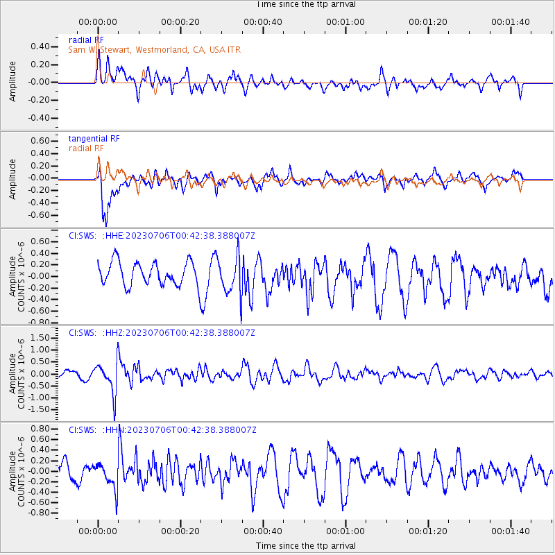
Signal To Noise
| Channel | StoN | STA | LTA |
| CI:SWS: :HHZ:20230706T00:42:38.388007Z | 4.788551 | 6.775129E-7 | 1.41486E-7 |
| CI:SWS: :HHN:20230706T00:42:38.388007Z | 1.2954328 | 2.4517792E-7 | 1.8926332E-7 |
| CI:SWS: :HHE:20230706T00:42:38.388007Z | 1.6693085 | 3.3063034E-7 | 1.9806426E-7 |
| Arrivals |
| Ps | |
| PpPs | |
| PsPs/PpSs | |


