You are here: Home > Network List > G - GEOSCOPE Stations List
> Station TAOE Taiohae, Marquises islands > Earthquake Result Viewer
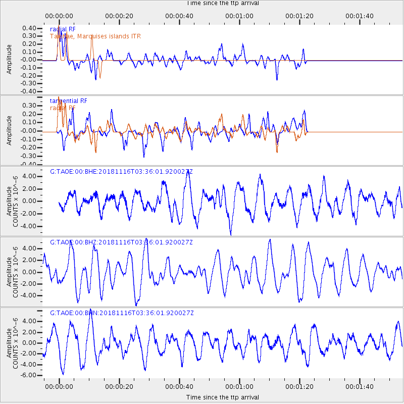
TAOE Taiohae, Marquises islands - Earthquake Result Viewer
*The percent match for this event was below the threshold and hence no stack was calculated.
| Earthquake location: |
Solomon Islands |
| Earthquake latitude/longitude: |
-10.5/163.1 |
| Earthquake time(UTC): |
2018/11/16 (320) 03:26:55 GMT |
| Earthquake Depth: |
11 km |
| Earthquake Magnitude: |
6.2 mww |
| Earthquake Catalog/Contributor: |
NEIC PDE/us |
|
| Network: |
G GEOSCOPE |
| Station: |
TAOE Taiohae, Marquises islands |
| Lat/Lon: |
8.85 S/140.15 W |
| Elevation: |
800 m |
|
| Distance: |
55.9 deg |
| Az: |
93.599 deg |
| Baz: |
263.281 deg |
| Ray Param: |
$rayparam |
*The percent match for this event was below the threshold and hence was not used in the summary stack. |
|
| Radial Match: |
75.41195 % |
| Radial Bump: |
400 |
| Transverse Match: |
70.212 % |
| Transverse Bump: |
400 |
| SOD ConfigId: |
3165032 |
| Insert Time: |
2018-11-30 03:33:16.634 +0000 |
| GWidth: |
2.5 |
| Max Bumps: |
400 |
| Tol: |
0.001 |
|
Signal To Noise
| Channel | StoN | STA | LTA |
| G:TAOE:00:BHZ:20181116T03:36:01.920027Z | 1.6812005 | 2.5767597E-6 | 1.5326902E-6 |
| G:TAOE:00:BHN:20181116T03:36:01.920027Z | 1.9891617 | 3.228889E-6 | 1.623241E-6 |
| G:TAOE:00:BHE:20181116T03:36:01.920027Z | 1.1516913 | 1.305241E-6 | 1.1333253E-6 |
| Arrivals |
| Ps | |
| PpPs | |
| PsPs/PpSs | |


