You are here: Home > Network List > IW - Intermountain West Stations List
> Station PLID Pearl Lake, Idaho, USA > Earthquake Result Viewer
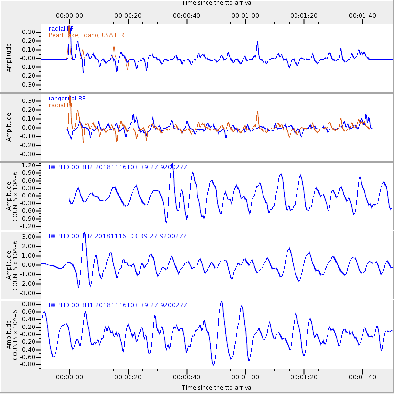
PLID Pearl Lake, Idaho, USA - Earthquake Result Viewer
*The percent match for this event was below the threshold and hence no stack was calculated.
| Earthquake location: |
Solomon Islands |
| Earthquake latitude/longitude: |
-10.5/163.1 |
| Earthquake time(UTC): |
2018/11/16 (320) 03:26:55 GMT |
| Earthquake Depth: |
11 km |
| Earthquake Magnitude: |
6.2 mww |
| Earthquake Catalog/Contributor: |
NEIC PDE/us |
|
| Network: |
IW Intermountain West |
| Station: |
PLID Pearl Lake, Idaho, USA |
| Lat/Lon: |
45.09 N/116.00 W |
| Elevation: |
2164 m |
|
| Distance: |
91.0 deg |
| Az: |
44.39 deg |
| Baz: |
256.189 deg |
| Ray Param: |
$rayparam |
*The percent match for this event was below the threshold and hence was not used in the summary stack. |
|
| Radial Match: |
47.914997 % |
| Radial Bump: |
400 |
| Transverse Match: |
50.01582 % |
| Transverse Bump: |
400 |
| SOD ConfigId: |
3165032 |
| Insert Time: |
2018-11-30 03:34:12.312 +0000 |
| GWidth: |
2.5 |
| Max Bumps: |
400 |
| Tol: |
0.001 |
|
Signal To Noise
| Channel | StoN | STA | LTA |
| IW:PLID:00:BHZ:20181116T03:39:27.920027Z | 4.700611 | 1.2515299E-6 | 2.6624835E-7 |
| IW:PLID:00:BH1:20181116T03:39:27.920027Z | 0.74905854 | 2.2484464E-7 | 3.0016963E-7 |
| IW:PLID:00:BH2:20181116T03:39:27.920027Z | 2.4742796 | 5.226589E-7 | 2.1123681E-7 |
| Arrivals |
| Ps | |
| PpPs | |
| PsPs/PpSs | |


