You are here: Home > Network List > US - United States National Seismic Network Stations List
> Station MSO Missoula, Montana, USA > Earthquake Result Viewer
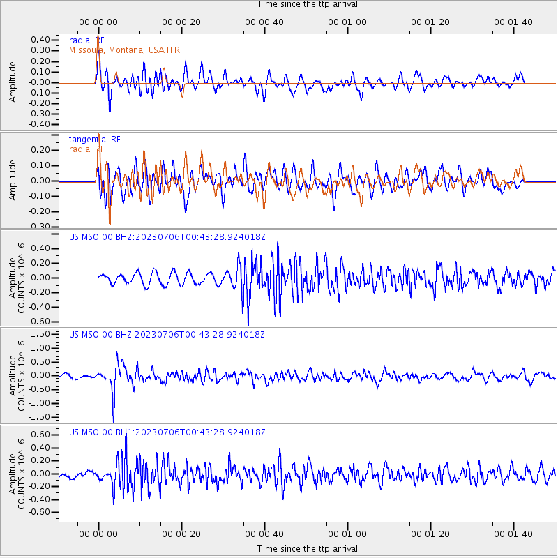
MSO Missoula, Montana, USA - Earthquake Result Viewer
*The percent match for this event was below the threshold and hence no stack was calculated.
| Earthquake location: |
Chile-Argentina Border Region |
| Earthquake latitude/longitude: |
-23.9/-67.9 |
| Earthquake time(UTC): |
2023/07/06 (187) 00:31:55 GMT |
| Earthquake Depth: |
132 km |
| Earthquake Magnitude: |
5.8 mww |
| Earthquake Catalog/Contributor: |
NEIC PDE/us |
|
| Network: |
US United States National Seismic Network |
| Station: |
MSO Missoula, Montana, USA |
| Lat/Lon: |
46.83 N/113.94 W |
| Elevation: |
1264 m |
|
| Distance: |
81.8 deg |
| Az: |
330.045 deg |
| Baz: |
138.283 deg |
| Ray Param: |
$rayparam |
*The percent match for this event was below the threshold and hence was not used in the summary stack. |
|
| Radial Match: |
71.434166 % |
| Radial Bump: |
400 |
| Transverse Match: |
65.95353 % |
| Transverse Bump: |
400 |
| SOD ConfigId: |
30536071 |
| Insert Time: |
2023-07-20 01:02:37.374 +0000 |
| GWidth: |
2.5 |
| Max Bumps: |
400 |
| Tol: |
0.001 |
|
Signal To Noise
| Channel | StoN | STA | LTA |
| US:MSO:00:BHZ:20230706T00:43:28.924018Z | 5.738918 | 4.873947E-7 | 8.4927976E-8 |
| US:MSO:00:BH1:20230706T00:43:28.924018Z | 1.936258 | 1.4906432E-7 | 7.698578E-8 |
| US:MSO:00:BH2:20230706T00:43:28.924018Z | 2.049852 | 1.5776507E-7 | 7.6964135E-8 |
| Arrivals |
| Ps | |
| PpPs | |
| PsPs/PpSs | |


