You are here: Home > Network List > TA - USArray Transportable Network (new EarthScope stations) Stations List
> Station F22A Rosebud, MT, USA > Earthquake Result Viewer
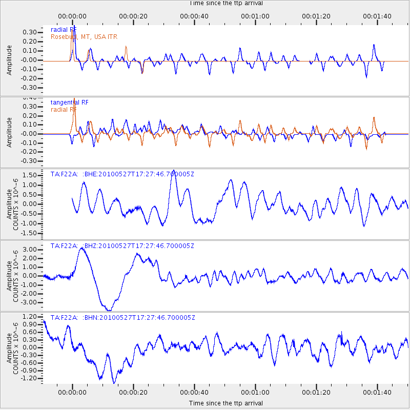
F22A Rosebud, MT, USA - Earthquake Result Viewer
*The percent match for this event was below the threshold and hence no stack was calculated.
| Earthquake location: |
Vanuatu Islands |
| Earthquake latitude/longitude: |
-13.7/166.6 |
| Earthquake time(UTC): |
2010/05/27 (147) 17:14:46 GMT |
| Earthquake Depth: |
31 km |
| Earthquake Magnitude: |
6.2 MB, 7.1 MS, 7.1 MW, 7.0 MW |
| Earthquake Catalog/Contributor: |
WHDF/NEIC |
|
| Network: |
TA USArray Transportable Network (new EarthScope stations) |
| Station: |
F22A Rosebud, MT, USA |
| Lat/Lon: |
45.78 N/106.26 W |
| Elevation: |
882 m |
|
| Distance: |
97.7 deg |
| Az: |
44.85 deg |
| Baz: |
258.369 deg |
| Ray Param: |
$rayparam |
*The percent match for this event was below the threshold and hence was not used in the summary stack. |
|
| Radial Match: |
60.407402 % |
| Radial Bump: |
400 |
| Transverse Match: |
24.514668 % |
| Transverse Bump: |
400 |
| SOD ConfigId: |
314592 |
| Insert Time: |
2010-09-14 07:39:18.147 +0000 |
| GWidth: |
2.5 |
| Max Bumps: |
400 |
| Tol: |
0.001 |
|
Signal To Noise
| Channel | StoN | STA | LTA |
| TA:F22A: :BHZ:20100527T17:27:46.700005Z | 14.552525 | 2.2330235E-6 | 1.5344578E-7 |
| TA:F22A: :BHN:20100527T17:27:46.700005Z | 1.5310704 | 6.63745E-7 | 4.3351702E-7 |
| TA:F22A: :BHE:20100527T17:27:46.700005Z | 2.3294215 | 1.1006554E-6 | 4.7250157E-7 |
| Arrivals |
| Ps | |
| PpPs | |
| PsPs/PpSs | |


