You are here: Home > Network List > AV - Alaska Volcano Observatory Stations List
> Station MAPS Pakushin Southeast, Makushin Volcano, Alaska > Earthquake Result Viewer
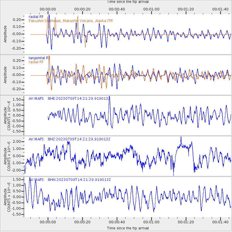
MAPS Pakushin Southeast, Makushin Volcano, Alaska - Earthquake Result Viewer
*The percent match for this event was below the threshold and hence no stack was calculated.
| Earthquake location: |
Northern Sumatra, Indonesia |
| Earthquake latitude/longitude: |
5.4/94.6 |
| Earthquake time(UTC): |
2023/07/09 (190) 14:09:04 GMT |
| Earthquake Depth: |
54 km |
| Earthquake Magnitude: |
5.4 Mww |
| Earthquake Catalog/Contributor: |
NEIC PDE/us |
|
| Network: |
AV Alaska Volcano Observatory |
| Station: |
MAPS Pakushin Southeast, Makushin Volcano, Alaska |
| Lat/Lon: |
53.81 N/166.94 W |
| Elevation: |
333 m |
|
| Distance: |
90.7 deg |
| Az: |
35.918 deg |
| Baz: |
279.982 deg |
| Ray Param: |
$rayparam |
*The percent match for this event was below the threshold and hence was not used in the summary stack. |
|
| Radial Match: |
52.93599 % |
| Radial Bump: |
400 |
| Transverse Match: |
49.721153 % |
| Transverse Bump: |
400 |
| SOD ConfigId: |
30536071 |
| Insert Time: |
2023-07-23 14:14:08.088 +0000 |
| GWidth: |
2.5 |
| Max Bumps: |
400 |
| Tol: |
0.001 |
|
Signal To Noise
| Channel | StoN | STA | LTA |
| AV:MAPS: :BHZ:20230709T14:21:29.919013Z | 1.0076863 | 8.810318E-7 | 8.743116E-7 |
| AV:MAPS: :BHN:20230709T14:21:29.919013Z | 1.1508118 | 6.803195E-7 | 5.9116485E-7 |
| AV:MAPS: :BHE:20230709T14:21:29.919013Z | 1.0087206 | 4.0233903E-7 | 3.9886072E-7 |
| Arrivals |
| Ps | |
| PpPs | |
| PsPs/PpSs | |


