You are here: Home > Network List > IU - Global Seismograph Network (GSN - IRIS/USGS) Stations List
> Station RSSD Black Hills, South Dakota, USA > Earthquake Result Viewer
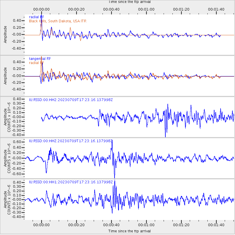
RSSD Black Hills, South Dakota, USA - Earthquake Result Viewer
*The percent match for this event was below the threshold and hence no stack was calculated.
| Earthquake location: |
Chile-Argentina Border Region |
| Earthquake latitude/longitude: |
-33.2/-70.3 |
| Earthquake time(UTC): |
2023/07/09 (190) 17:11:33 GMT |
| Earthquake Depth: |
102 km |
| Earthquake Magnitude: |
5.6 Mww |
| Earthquake Catalog/Contributor: |
NEIC PDE/us |
|
| Network: |
IU Global Seismograph Network (GSN - IRIS/USGS) |
| Station: |
RSSD Black Hills, South Dakota, USA |
| Lat/Lon: |
44.12 N/104.04 W |
| Elevation: |
2090 m |
|
| Distance: |
82.9 deg |
| Az: |
336.246 deg |
| Baz: |
152.039 deg |
| Ray Param: |
$rayparam |
*The percent match for this event was below the threshold and hence was not used in the summary stack. |
|
| Radial Match: |
77.72122 % |
| Radial Bump: |
400 |
| Transverse Match: |
65.48497 % |
| Transverse Bump: |
400 |
| SOD ConfigId: |
30536071 |
| Insert Time: |
2023-07-23 17:23:37.080 +0000 |
| GWidth: |
2.5 |
| Max Bumps: |
400 |
| Tol: |
0.001 |
|
Signal To Noise
| Channel | StoN | STA | LTA |
| IU:RSSD:00:HHZ:20230709T17:23:16.137998Z | 4.599585 | 2.0091956E-7 | 4.3682107E-8 |
| IU:RSSD:00:HH1:20230709T17:23:16.137998Z | 2.131481 | 7.558045E-8 | 3.5459127E-8 |
| IU:RSSD:00:HH2:20230709T17:23:16.137998Z | 2.614473 | 7.307645E-8 | 2.7950737E-8 |
| Arrivals |
| Ps | |
| PpPs | |
| PsPs/PpSs | |


