You are here: Home > Network List > TX - Texas Seismological Network Stations List
> Station WTFS Witchita Falls > Earthquake Result Viewer
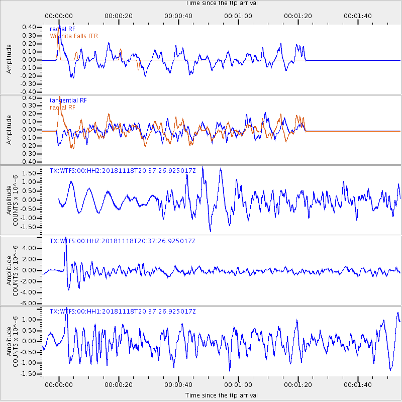
WTFS Witchita Falls - Earthquake Result Viewer
*The percent match for this event was below the threshold and hence no stack was calculated.
| Earthquake location: |
Fiji Islands Region |
| Earthquake latitude/longitude: |
-17.9/-178.9 |
| Earthquake time(UTC): |
2018/11/18 (322) 20:25:45 GMT |
| Earthquake Depth: |
534 km |
| Earthquake Magnitude: |
6.7 Mww |
| Earthquake Catalog/Contributor: |
NEIC PDE/us |
|
| Network: |
TX Texas Seismological Network |
| Station: |
WTFS Witchita Falls |
| Lat/Lon: |
33.77 N/98.46 W |
| Elevation: |
277 m |
|
| Distance: |
92.1 deg |
| Az: |
55.287 deg |
| Baz: |
249.988 deg |
| Ray Param: |
$rayparam |
*The percent match for this event was below the threshold and hence was not used in the summary stack. |
|
| Radial Match: |
61.104084 % |
| Radial Bump: |
400 |
| Transverse Match: |
56.784203 % |
| Transverse Bump: |
400 |
| SOD ConfigId: |
3165032 |
| Insert Time: |
2018-12-02 20:36:25.463 +0000 |
| GWidth: |
2.5 |
| Max Bumps: |
400 |
| Tol: |
0.001 |
|
Signal To Noise
| Channel | StoN | STA | LTA |
| TX:WTFS:00:HHZ:20181118T20:37:26.925017Z | 8.198048 | 2.0971547E-6 | 2.5581147E-7 |
| TX:WTFS:00:HH1:20181118T20:37:26.925017Z | 2.520564 | 6.8389386E-7 | 2.7132572E-7 |
| TX:WTFS:00:HH2:20181118T20:37:26.925017Z | 0.634942 | 2.6881642E-7 | 4.2337163E-7 |
| Arrivals |
| Ps | |
| PpPs | |
| PsPs/PpSs | |


