You are here: Home > Network List > CI - Caltech Regional Seismic Network Stations List
> Station MPM Manuel Prospect Mine, California, USA > Earthquake Result Viewer
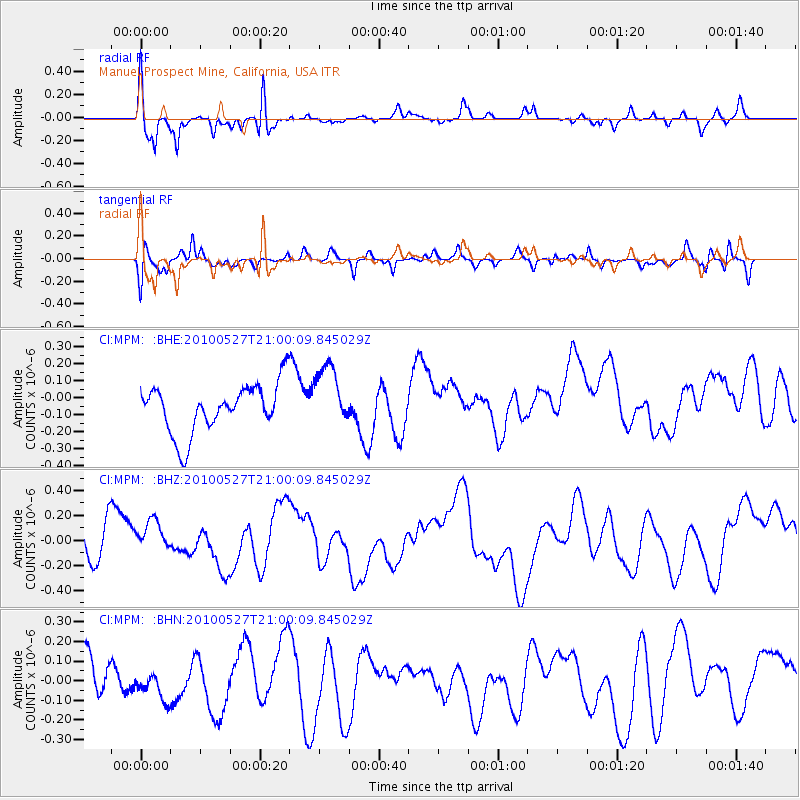
MPM Manuel Prospect Mine, California, USA - Earthquake Result Viewer
*The percent match for this event was below the threshold and hence no stack was calculated.
| Earthquake location: |
Vanuatu Islands |
| Earthquake latitude/longitude: |
-13.7/166.7 |
| Earthquake time(UTC): |
2010/05/27 (147) 20:48:00 GMT |
| Earthquake Depth: |
35 km |
| Earthquake Magnitude: |
5.7 MB, 5.3 MS |
| Earthquake Catalog/Contributor: |
WHDF/NEIC |
|
| Network: |
CI Caltech Regional Seismic Network |
| Station: |
MPM Manuel Prospect Mine, California, USA |
| Lat/Lon: |
36.06 N/117.49 W |
| Elevation: |
185 m |
|
| Distance: |
86.8 deg |
| Az: |
51.875 deg |
| Baz: |
250.688 deg |
| Ray Param: |
$rayparam |
*The percent match for this event was below the threshold and hence was not used in the summary stack. |
|
| Radial Match: |
70.49911 % |
| Radial Bump: |
306 |
| Transverse Match: |
50.144005 % |
| Transverse Bump: |
375 |
| SOD ConfigId: |
314592 |
| Insert Time: |
2010-09-14 07:57:08.155 +0000 |
| GWidth: |
2.5 |
| Max Bumps: |
400 |
| Tol: |
0.001 |
|
Signal To Noise
| Channel | StoN | STA | LTA |
| CI:MPM: :BHZ:20100527T21:00:09.845029Z | 0.53456557 | 1.3032893E-7 | 2.4380344E-7 |
| CI:MPM: :BHN:20100527T21:00:09.845029Z | 0.6749158 | 7.7414136E-8 | 1.1470191E-7 |
| CI:MPM: :BHE:20100527T21:00:09.845029Z | 1.3024461 | 1.8545215E-7 | 1.4238759E-7 |
| Arrivals |
| Ps | |
| PpPs | |
| PsPs/PpSs | |


