You are here: Home > Network List > TA - USArray Transportable Network (new EarthScope stations) Stations List
> Station 113A Mohawk Valley, Roll, AZ, USA > Earthquake Result Viewer
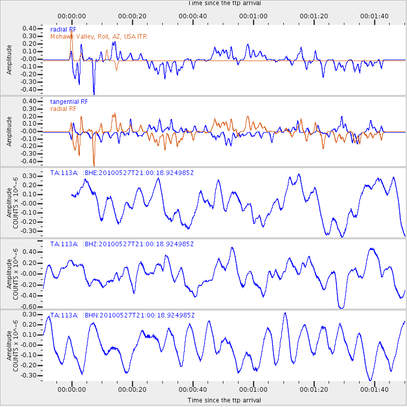
113A Mohawk Valley, Roll, AZ, USA - Earthquake Result Viewer
*The percent match for this event was below the threshold and hence no stack was calculated.
| Earthquake location: |
Vanuatu Islands |
| Earthquake latitude/longitude: |
-13.7/166.7 |
| Earthquake time(UTC): |
2010/05/27 (147) 20:48:00 GMT |
| Earthquake Depth: |
35 km |
| Earthquake Magnitude: |
5.7 MB, 5.3 MS |
| Earthquake Catalog/Contributor: |
WHDF/NEIC |
|
| Network: |
TA USArray Transportable Network (new EarthScope stations) |
| Station: |
113A Mohawk Valley, Roll, AZ, USA |
| Lat/Lon: |
32.77 N/113.77 W |
| Elevation: |
118 m |
|
| Distance: |
88.7 deg |
| Az: |
55.955 deg |
| Baz: |
252.945 deg |
| Ray Param: |
$rayparam |
*The percent match for this event was below the threshold and hence was not used in the summary stack. |
|
| Radial Match: |
79.70449 % |
| Radial Bump: |
400 |
| Transverse Match: |
43.611317 % |
| Transverse Bump: |
400 |
| SOD ConfigId: |
314592 |
| Insert Time: |
2010-09-14 07:59:25.310 +0000 |
| GWidth: |
2.5 |
| Max Bumps: |
400 |
| Tol: |
0.001 |
|
Signal To Noise
| Channel | StoN | STA | LTA |
| TA:113A: :BHZ:20100527T21:00:18.924985Z | 1.020199 | 1.8706099E-7 | 1.8335737E-7 |
| TA:113A: :BHN:20100527T21:00:18.924985Z | 1.652584 | 1.9700568E-7 | 1.1921068E-7 |
| TA:113A: :BHE:20100527T21:00:18.924985Z | 1.3083218 | 1.5997388E-7 | 1.222741E-7 |
| Arrivals |
| Ps | |
| PpPs | |
| PsPs/PpSs | |


