You are here: Home > Network List > IU - Global Seismograph Network (GSN - IRIS/USGS) Stations List
> Station CTAO Charters Towers, Australia > Earthquake Result Viewer
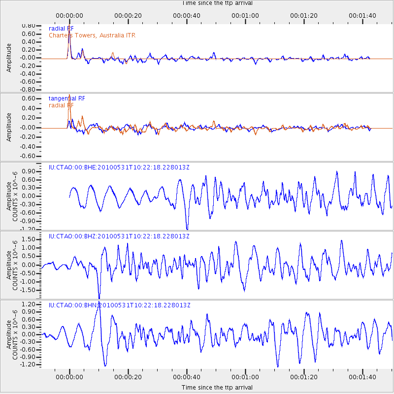
CTAO Charters Towers, Australia - Earthquake Result Viewer
*The percent match for this event was below the threshold and hence no stack was calculated.
| Earthquake location: |
Mindanao, Philippines |
| Earthquake latitude/longitude: |
7.0/124.0 |
| Earthquake time(UTC): |
2010/05/31 (151) 10:16:02 GMT |
| Earthquake Depth: |
35 km |
| Earthquake Magnitude: |
5.7 MB, 5.5 MS, 5.9 MW, 5.9 MW |
| Earthquake Catalog/Contributor: |
WHDF/NEIC |
|
| Network: |
IU Global Seismograph Network (GSN - IRIS/USGS) |
| Station: |
CTAO Charters Towers, Australia |
| Lat/Lon: |
20.09 S/146.25 E |
| Elevation: |
357 m |
|
| Distance: |
34.7 deg |
| Az: |
141.254 deg |
| Baz: |
318.62 deg |
| Ray Param: |
$rayparam |
*The percent match for this event was below the threshold and hence was not used in the summary stack. |
|
| Radial Match: |
69.32034 % |
| Radial Bump: |
294 |
| Transverse Match: |
67.70637 % |
| Transverse Bump: |
398 |
| SOD ConfigId: |
317696 |
| Insert Time: |
2010-09-19 06:37:05.959 +0000 |
| GWidth: |
2.5 |
| Max Bumps: |
400 |
| Tol: |
0.001 |
|
Signal To Noise
| Channel | StoN | STA | LTA |
| IU:CTAO:00:BHZ:20100531T10:22:18.228013Z | 1.0677843 | 2.5030764E-7 | 2.344178E-7 |
| IU:CTAO:00:BHN:20100531T10:22:18.228013Z | 2.3010793 | 3.0466057E-7 | 1.32399E-7 |
| IU:CTAO:00:BHE:20100531T10:22:18.228013Z | 0.7687865 | 2.0195904E-7 | 2.6269848E-7 |
| Arrivals |
| Ps | |
| PpPs | |
| PsPs/PpSs | |


