
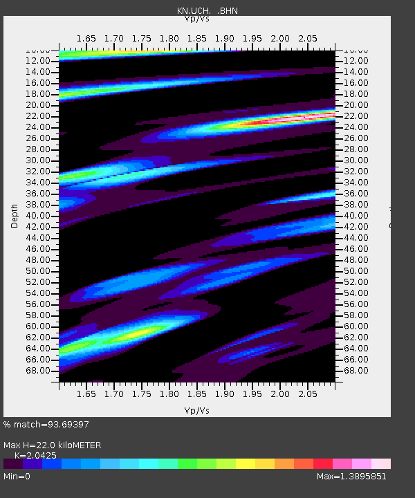
UCH KN.UCH - Earthquake Result Viewer
| ||||||||||||||||||
| ||||||||||||||||||
| ||||||||||||||||||
|
Signal To Noise
| Channel | StoN | STA | LTA |
| KN:UCH: :BHZ:20100531T10:25:06.65001Z | 28.066805 | 1.4644062E-6 | 5.217574E-8 |
| KN:UCH: :BHN:20100531T10:25:06.65001Z | 4.395158 | 3.2293772E-7 | 7.3475796E-8 |
| KN:UCH: :BHE:20100531T10:25:06.65001Z | 14.144812 | 6.536371E-7 | 4.6210374E-8 |
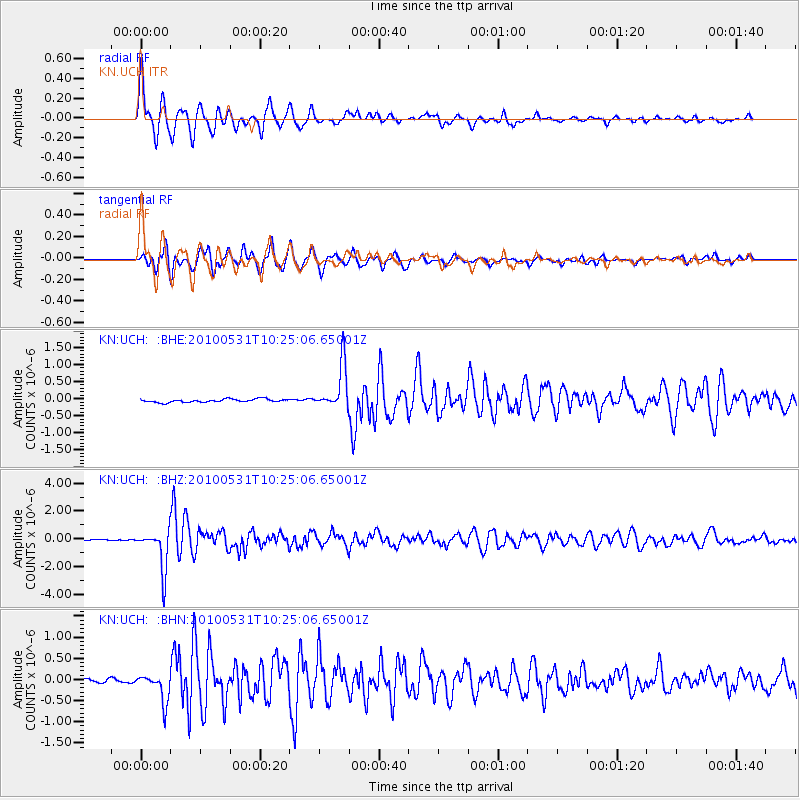
| Arrivals | |
| Ps | 3.8 SECOND |
| PpPs | 10 SECOND |
| PsPs/PpSs | 14 SECOND |

