You are here: Home > Network List > AV - Alaska Volcano Observatory Stations List
> Station SPU Mount Spurr, Mount Spurr, Alaska > Earthquake Result Viewer
SPU Mount Spurr, Mount Spurr, Alaska - Earthquake Result Viewer

| Earthquake location: |
Near Coast Of Chiapas, Mexico |
| Earthquake latitude/longitude: |
15.0/-93.9 |
| Earthquake time(UTC): |
2023/07/14 (195) 09:29:01 GMT |
| Earthquake Depth: |
35 km |
| Earthquake Magnitude: |
6.3 mww |
| Earthquake Catalog/Contributor: |
NEIC PDE/us |
|
| Network: |
AV Alaska Volcano Observatory |
| Station: |
SPU Mount Spurr, Mount Spurr, Alaska |
| Lat/Lon: |
61.18 N/152.06 W |
| Elevation: |
800 m |
|
| Distance: |
61.8 deg |
| Az: |
332.154 deg |
| Baz: |
111.34 deg |
| Ray Param: |
0.060577847 |
| Estimated Moho Depth: |
69.75 km |
| Estimated Crust Vp/Vs: |
1.90 |
| Assumed Crust Vp: |
6.566 km/s |
| Estimated Crust Vs: |
3.456 km/s |
| Estimated Crust Poisson's Ratio: |
0.31 |
|
| Radial Match: |
90.85946 % |
| Radial Bump: |
400 |
| Transverse Match: |
91.21219 % |
| Transverse Bump: |
400 |
| SOD ConfigId: |
30536071 |
| Insert Time: |
2023-07-28 09:40:36.263 +0000 |
| GWidth: |
2.5 |
| Max Bumps: |
400 |
| Tol: |
0.001 |
|
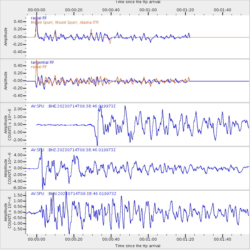
Signal To Noise
| Channel | StoN | STA | LTA |
| AV:SPU: :BHZ:20230714T09:38:46.019973Z | 61.215923 | 3.2741445E-6 | 5.3485174E-8 |
| AV:SPU: :BHN:20230714T09:38:46.019973Z | 7.4708157 | 3.7739827E-7 | 5.0516338E-8 |
| AV:SPU: :BHE:20230714T09:38:46.019973Z | 41.881863 | 1.4464395E-6 | 3.453618E-8 |
| Arrivals |
| Ps | 10.0 SECOND |
| PpPs | 29 SECOND |
| PsPs/PpSs | 39 SECOND |


