You are here: Home > Network List > TA - USArray Transportable Network (new EarthScope stations) Stations List
> Station Q24A Divide, CO, USA > Earthquake Result Viewer
Q24A Divide, CO, USA - Earthquake Result Viewer

| Earthquake location: |
Costa Rica |
| Earthquake latitude/longitude: |
9.3/-84.2 |
| Earthquake time(UTC): |
2010/06/01 (152) 03:26:15 GMT |
| Earthquake Depth: |
18 km |
| Earthquake Magnitude: |
5.7 MB, 5.6 MS, 6.0 MW, 5.9 MW |
| Earthquake Catalog/Contributor: |
WHDF/NEIC |
|
| Network: |
TA USArray Transportable Network (new EarthScope stations) |
| Station: |
Q24A Divide, CO, USA |
| Lat/Lon: |
38.96 N/105.15 W |
| Elevation: |
2775 m |
|
| Distance: |
35.0 deg |
| Az: |
330.908 deg |
| Baz: |
142.01 deg |
| Ray Param: |
0.07744868 |
| Estimated Moho Depth: |
19.75 km |
| Estimated Crust Vp/Vs: |
1.93 |
| Assumed Crust Vp: |
6.159 km/s |
| Estimated Crust Vs: |
3.183 km/s |
| Estimated Crust Poisson's Ratio: |
0.32 |
|
| Radial Match: |
85.774475 % |
| Radial Bump: |
337 |
| Transverse Match: |
77.61476 % |
| Transverse Bump: |
362 |
| SOD ConfigId: |
317696 |
| Insert Time: |
2010-09-19 07:01:20.536 +0000 |
| GWidth: |
2.5 |
| Max Bumps: |
400 |
| Tol: |
0.001 |
|
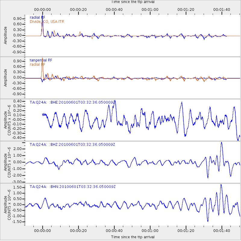
Signal To Noise
| Channel | StoN | STA | LTA |
| TA:Q24A: :BHZ:20100601T03:32:36.050009Z | 2.553605 | 3.791232E-7 | 1.4846587E-7 |
| TA:Q24A: :BHN:20100601T03:32:36.050009Z | 2.6002896 | 3.070864E-7 | 1.18097E-7 |
| TA:Q24A: :BHE:20100601T03:32:36.050009Z | 0.96905416 | 1.1172366E-7 | 1.1529144E-7 |
| Arrivals |
| Ps | 3.2 SECOND |
| PpPs | 8.8 SECOND |
| PsPs/PpSs | 12 SECOND |


