You are here: Home > Network List > TA - USArray Transportable Network (new EarthScope stations) Stations List
> Station H20A Greybull, WY, USA > Earthquake Result Viewer
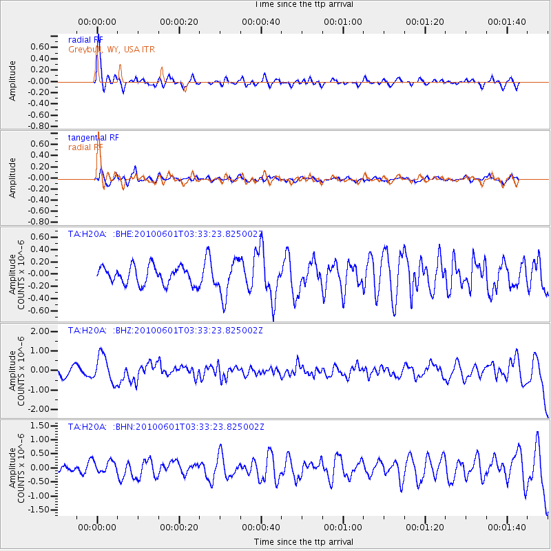
H20A Greybull, WY, USA - Earthquake Result Viewer
*The percent match for this event was below the threshold and hence no stack was calculated.
| Earthquake location: |
Costa Rica |
| Earthquake latitude/longitude: |
9.3/-84.2 |
| Earthquake time(UTC): |
2010/06/01 (152) 03:26:15 GMT |
| Earthquake Depth: |
18 km |
| Earthquake Magnitude: |
5.7 MB, 5.6 MS, 6.0 MW, 5.9 MW |
| Earthquake Catalog/Contributor: |
WHDF/NEIC |
|
| Network: |
TA USArray Transportable Network (new EarthScope stations) |
| Station: |
H20A Greybull, WY, USA |
| Lat/Lon: |
44.49 N/108.00 W |
| Elevation: |
1236 m |
|
| Distance: |
40.6 deg |
| Az: |
333.679 deg |
| Baz: |
142.31 deg |
| Ray Param: |
$rayparam |
*The percent match for this event was below the threshold and hence was not used in the summary stack. |
|
| Radial Match: |
66.085815 % |
| Radial Bump: |
395 |
| Transverse Match: |
52.833153 % |
| Transverse Bump: |
400 |
| SOD ConfigId: |
317696 |
| Insert Time: |
2010-09-19 07:01:57.086 +0000 |
| GWidth: |
2.5 |
| Max Bumps: |
400 |
| Tol: |
0.001 |
|
Signal To Noise
| Channel | StoN | STA | LTA |
| TA:H20A: :BHZ:20100601T03:33:23.825002Z | 3.9496074 | 7.0718664E-7 | 1.7905239E-7 |
| TA:H20A: :BHN:20100601T03:33:23.825002Z | 1.3923024 | 2.1263392E-7 | 1.5272107E-7 |
| TA:H20A: :BHE:20100601T03:33:23.825002Z | 2.0756707 | 2.967818E-7 | 1.4298115E-7 |
| Arrivals |
| Ps | |
| PpPs | |
| PsPs/PpSs | |


