You are here: Home > Network List > TA - USArray Transportable Network (new EarthScope stations) Stations List
> Station I20A Worland, WY, USA > Earthquake Result Viewer
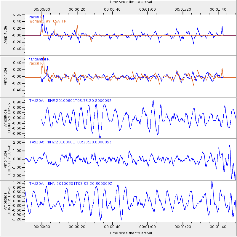
I20A Worland, WY, USA - Earthquake Result Viewer
*The percent match for this event was below the threshold and hence no stack was calculated.
| Earthquake location: |
Costa Rica |
| Earthquake latitude/longitude: |
9.3/-84.2 |
| Earthquake time(UTC): |
2010/06/01 (152) 03:26:15 GMT |
| Earthquake Depth: |
18 km |
| Earthquake Magnitude: |
5.7 MB, 5.6 MS, 6.0 MW, 5.9 MW |
| Earthquake Catalog/Contributor: |
WHDF/NEIC |
|
| Network: |
TA USArray Transportable Network (new EarthScope stations) |
| Station: |
I20A Worland, WY, USA |
| Lat/Lon: |
43.95 N/108.13 W |
| Elevation: |
1342 m |
|
| Distance: |
40.3 deg |
| Az: |
333.057 deg |
| Baz: |
141.747 deg |
| Ray Param: |
$rayparam |
*The percent match for this event was below the threshold and hence was not used in the summary stack. |
|
| Radial Match: |
50.479565 % |
| Radial Bump: |
316 |
| Transverse Match: |
68.46047 % |
| Transverse Bump: |
389 |
| SOD ConfigId: |
317696 |
| Insert Time: |
2010-09-19 07:01:58.109 +0000 |
| GWidth: |
2.5 |
| Max Bumps: |
400 |
| Tol: |
0.001 |
|
Signal To Noise
| Channel | StoN | STA | LTA |
| TA:I20A: :BHZ:20100601T03:33:20.800009Z | 4.3389106 | 4.4391734E-7 | 1.0231078E-7 |
| TA:I20A: :BHN:20100601T03:33:20.800009Z | 0.97875535 | 4.554893E-7 | 4.6537608E-7 |
| TA:I20A: :BHE:20100601T03:33:20.800009Z | 1.9372822 | 6.614083E-7 | 3.4141038E-7 |
| Arrivals |
| Ps | |
| PpPs | |
| PsPs/PpSs | |


