You are here: Home > Network List > TA - USArray Transportable Network (new EarthScope stations) Stations List
> Station P27A Ficken Ranch, Kirk, CO, USA > Earthquake Result Viewer
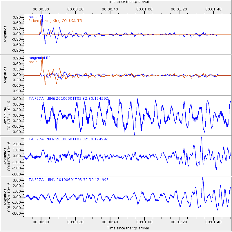
P27A Ficken Ranch, Kirk, CO, USA - Earthquake Result Viewer
*The percent match for this event was below the threshold and hence no stack was calculated.
| Earthquake location: |
Costa Rica |
| Earthquake latitude/longitude: |
9.3/-84.2 |
| Earthquake time(UTC): |
2010/06/01 (152) 03:26:15 GMT |
| Earthquake Depth: |
18 km |
| Earthquake Magnitude: |
5.7 MB, 5.6 MS, 6.0 MW, 5.9 MW |
| Earthquake Catalog/Contributor: |
WHDF/NEIC |
|
| Network: |
TA USArray Transportable Network (new EarthScope stations) |
| Station: |
P27A Ficken Ranch, Kirk, CO, USA |
| Lat/Lon: |
39.56 N/102.58 W |
| Elevation: |
1286 m |
|
| Distance: |
34.3 deg |
| Az: |
334.366 deg |
| Baz: |
146.477 deg |
| Ray Param: |
$rayparam |
*The percent match for this event was below the threshold and hence was not used in the summary stack. |
|
| Radial Match: |
76.753555 % |
| Radial Bump: |
254 |
| Transverse Match: |
40.982426 % |
| Transverse Bump: |
323 |
| SOD ConfigId: |
317696 |
| Insert Time: |
2010-09-19 07:06:35.448 +0000 |
| GWidth: |
2.5 |
| Max Bumps: |
400 |
| Tol: |
0.001 |
|
Signal To Noise
| Channel | StoN | STA | LTA |
| TA:P27A: :BHZ:20100601T03:32:30.12499Z | 3.6953015 | 6.0411423E-7 | 1.6348172E-7 |
| TA:P27A: :BHN:20100601T03:32:30.12499Z | 1.0591521 | 3.8119222E-7 | 3.5990317E-7 |
| TA:P27A: :BHE:20100601T03:32:30.12499Z | 1.3818411 | 4.5214574E-7 | 3.272053E-7 |
| Arrivals |
| Ps | |
| PpPs | |
| PsPs/PpSs | |


