You are here: Home > Network List > US - United States National Seismic Network Stations List
> Station HAWA Hanford, Washington, USA > Earthquake Result Viewer
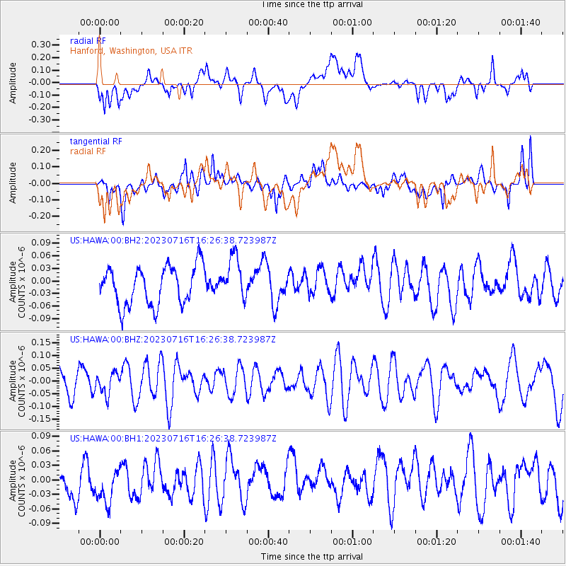
HAWA Hanford, Washington, USA - Earthquake Result Viewer
*The percent match for this event was below the threshold and hence no stack was calculated.
| Earthquake location: |
New Britain Region, P.N.G. |
| Earthquake latitude/longitude: |
-5.8/148.3 |
| Earthquake time(UTC): |
2023/07/16 (197) 16:14:00 GMT |
| Earthquake Depth: |
137 km |
| Earthquake Magnitude: |
5.1 Mww |
| Earthquake Catalog/Contributor: |
NEIC PDE/us |
|
| Network: |
US United States National Seismic Network |
| Station: |
HAWA Hanford, Washington, USA |
| Lat/Lon: |
46.39 N/119.53 W |
| Elevation: |
364 m |
|
| Distance: |
95.6 deg |
| Az: |
44.028 deg |
| Baz: |
267.609 deg |
| Ray Param: |
$rayparam |
*The percent match for this event was below the threshold and hence was not used in the summary stack. |
|
| Radial Match: |
55.277668 % |
| Radial Bump: |
400 |
| Transverse Match: |
42.211746 % |
| Transverse Bump: |
400 |
| SOD ConfigId: |
30536071 |
| Insert Time: |
2023-07-30 16:41:37.419 +0000 |
| GWidth: |
2.5 |
| Max Bumps: |
400 |
| Tol: |
0.001 |
|
Signal To Noise
| Channel | StoN | STA | LTA |
| US:HAWA:00:BHZ:20230716T16:26:38.723987Z | 0.85242254 | 4.237872E-8 | 4.9715624E-8 |
| US:HAWA:00:BH1:20230716T16:26:38.723987Z | 1.2058055 | 4.2957122E-8 | 3.562525E-8 |
| US:HAWA:00:BH2:20230716T16:26:38.723987Z | 1.1637415 | 5.393885E-8 | 4.6349513E-8 |
| Arrivals |
| Ps | |
| PpPs | |
| PsPs/PpSs | |


