You are here: Home > Network List > IW - Intermountain West Stations List
> Station MOOW Moose Ponds, Wyoming, USA > Earthquake Result Viewer
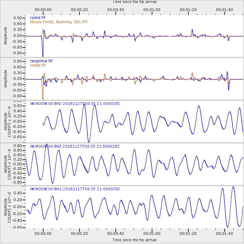
MOOW Moose Ponds, Wyoming, USA - Earthquake Result Viewer
*The percent match for this event was below the threshold and hence no stack was calculated.
| Earthquake location: |
Solomon Islands |
| Earthquake latitude/longitude: |
-7.1/154.8 |
| Earthquake time(UTC): |
2018/11/27 (331) 09:22:16 GMT |
| Earthquake Depth: |
10 km |
| Earthquake Magnitude: |
5.5 mb |
| Earthquake Catalog/Contributor: |
NEIC PDE/us |
|
| Network: |
IW Intermountain West |
| Station: |
MOOW Moose Ponds, Wyoming, USA |
| Lat/Lon: |
43.75 N/110.74 W |
| Elevation: |
2128 m |
|
| Distance: |
98.1 deg |
| Az: |
46.863 deg |
| Baz: |
267.974 deg |
| Ray Param: |
$rayparam |
*The percent match for this event was below the threshold and hence was not used in the summary stack. |
|
| Radial Match: |
66.792145 % |
| Radial Bump: |
400 |
| Transverse Match: |
65.74312 % |
| Transverse Bump: |
400 |
| SOD ConfigId: |
3165032 |
| Insert Time: |
2018-12-11 09:25:27.342 +0000 |
| GWidth: |
2.5 |
| Max Bumps: |
400 |
| Tol: |
0.001 |
|
Signal To Noise
| Channel | StoN | STA | LTA |
| IW:MOOW:00:BHZ:20181127T09:35:21.699028Z | 2.3312402 | 5.696459E-7 | 2.4435317E-7 |
| IW:MOOW:00:BH1:20181127T09:35:21.699028Z | 0.95161694 | 2.0057904E-7 | 2.1077709E-7 |
| IW:MOOW:00:BH2:20181127T09:35:21.699028Z | 0.852315 | 2.645978E-7 | 3.1044598E-7 |
| Arrivals |
| Ps | |
| PpPs | |
| PsPs/PpSs | |


