You are here: Home > Network List > G - GEOSCOPE Stations List
> Station FDF Fort de France, Martinique France > Earthquake Result Viewer
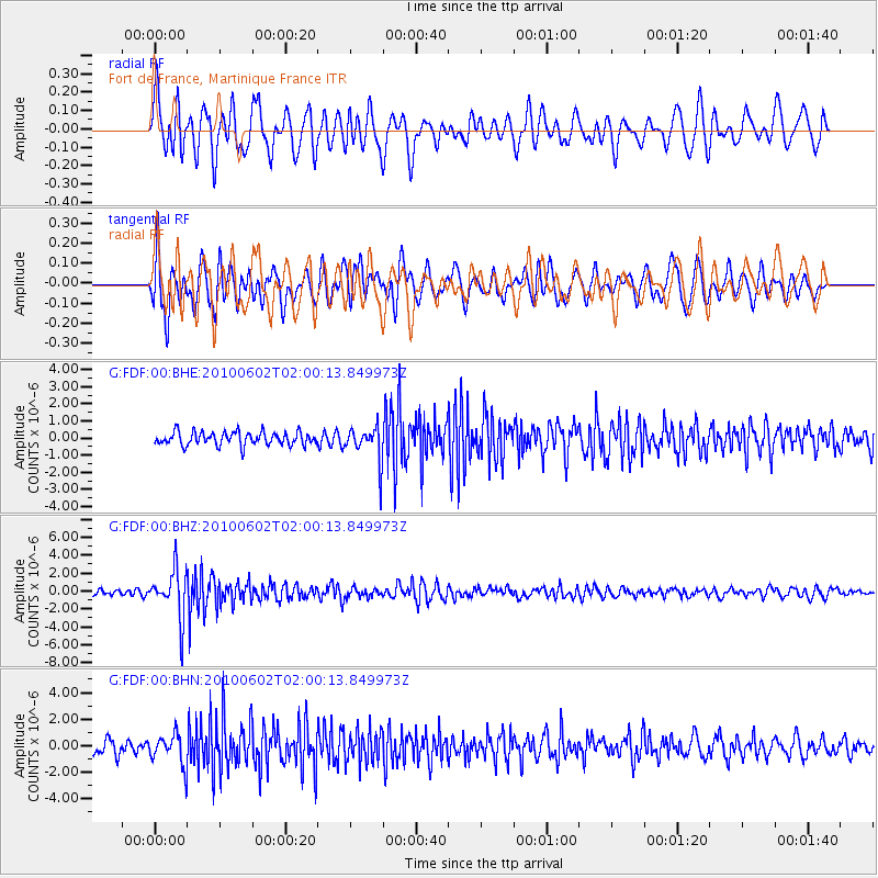
FDF Fort de France, Martinique France - Earthquake Result Viewer
*The percent match for this event was below the threshold and hence no stack was calculated.
| Earthquake location: |
South Sandwich Islands Region |
| Earthquake latitude/longitude: |
-57.4/-26.4 |
| Earthquake time(UTC): |
2010/06/02 (153) 01:49:03 GMT |
| Earthquake Depth: |
127 km |
| Earthquake Magnitude: |
5.9 MB, 5.9 MW, 5.9 MW |
| Earthquake Catalog/Contributor: |
WHDF/NEIC |
|
| Network: |
G GEOSCOPE |
| Station: |
FDF Fort de France, Martinique France |
| Lat/Lon: |
14.73 N/61.14 W |
| Elevation: |
467 m |
|
| Distance: |
77.4 deg |
| Az: |
325.64 deg |
| Baz: |
161.576 deg |
| Ray Param: |
$rayparam |
*The percent match for this event was below the threshold and hence was not used in the summary stack. |
|
| Radial Match: |
65.15665 % |
| Radial Bump: |
400 |
| Transverse Match: |
72.9363 % |
| Transverse Bump: |
400 |
| SOD ConfigId: |
317696 |
| Insert Time: |
2010-09-19 07:25:29.235 +0000 |
| GWidth: |
2.5 |
| Max Bumps: |
400 |
| Tol: |
0.001 |
|
Signal To Noise
| Channel | StoN | STA | LTA |
| G:FDF:00:BHZ:20100602T02:00:13.849973Z | 9.264143 | 2.643753E-6 | 2.853748E-7 |
| G:FDF:00:BHN:20100602T02:00:13.849973Z | 2.275986 | 1.17418E-6 | 5.1589956E-7 |
| G:FDF:00:BHE:20100602T02:00:13.849973Z | 2.681103 | 1.0273678E-6 | 3.8318848E-7 |
| Arrivals |
| Ps | |
| PpPs | |
| PsPs/PpSs | |


