You are here: Home > Network List > IW - Intermountain West Stations List
> Station DLMT Dillon, Montana, USA > Earthquake Result Viewer
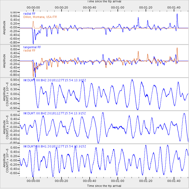
DLMT Dillon, Montana, USA - Earthquake Result Viewer
*The percent match for this event was below the threshold and hence no stack was calculated.
| Earthquake location: |
Southeast Of Loyalty Islands |
| Earthquake latitude/longitude: |
-21.3/171.3 |
| Earthquake time(UTC): |
2018/11/27 (331) 15:41:20 GMT |
| Earthquake Depth: |
10 km |
| Earthquake Magnitude: |
5.8 Mww |
| Earthquake Catalog/Contributor: |
NEIC PDE/us |
|
| Network: |
IW Intermountain West |
| Station: |
DLMT Dillon, Montana, USA |
| Lat/Lon: |
45.36 N/112.60 W |
| Elevation: |
1569 m |
|
| Distance: |
95.6 deg |
| Az: |
43.438 deg |
| Baz: |
245.395 deg |
| Ray Param: |
$rayparam |
*The percent match for this event was below the threshold and hence was not used in the summary stack. |
|
| Radial Match: |
53.34394 % |
| Radial Bump: |
400 |
| Transverse Match: |
65.05933 % |
| Transverse Bump: |
400 |
| SOD ConfigId: |
3165032 |
| Insert Time: |
2018-12-11 15:45:09.559 +0000 |
| GWidth: |
2.5 |
| Max Bumps: |
400 |
| Tol: |
0.001 |
|
Signal To Noise
| Channel | StoN | STA | LTA |
| IW:DLMT:00:BHZ:20181127T15:54:13.915Z | 1.905794 | 3.696565E-7 | 1.9396455E-7 |
| IW:DLMT:00:BH1:20181127T15:54:13.915Z | 1.7967887 | 4.9059634E-7 | 2.7304065E-7 |
| IW:DLMT:00:BH2:20181127T15:54:13.915Z | 0.8045457 | 3.7866093E-7 | 4.7065186E-7 |
| Arrivals |
| Ps | |
| PpPs | |
| PsPs/PpSs | |


